After three great years here in my ‘Treehouse’ beside the paperbarks, I have to downsize, spacewise and financially. The extra rooms here and the several car spaces are wasted on me.
I fell in love with here at once, so close to nature as it is, with such great views of the bush, the river and the mountain and with so many lovely bushwalks nearby.
As I have already borrowed to buy a smaller place elsewhere, I am very anxious to sell here as soon as possible. Please take a look and pass on the agent’s link to anyone who may be interested. Click on the photo to see the full listing.
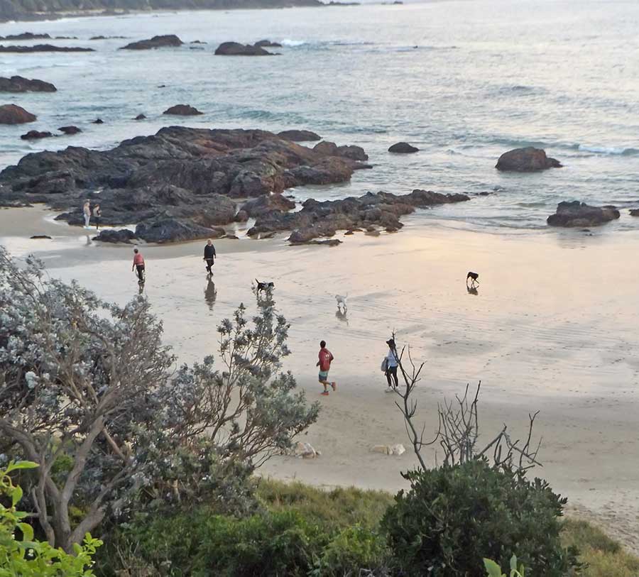
Today I dared my first beach walk, after a week flu-bound indoors, basically doing nought but coughing and sleeping.
The beach was pretty empty, although several fishermen were risking the rocks.
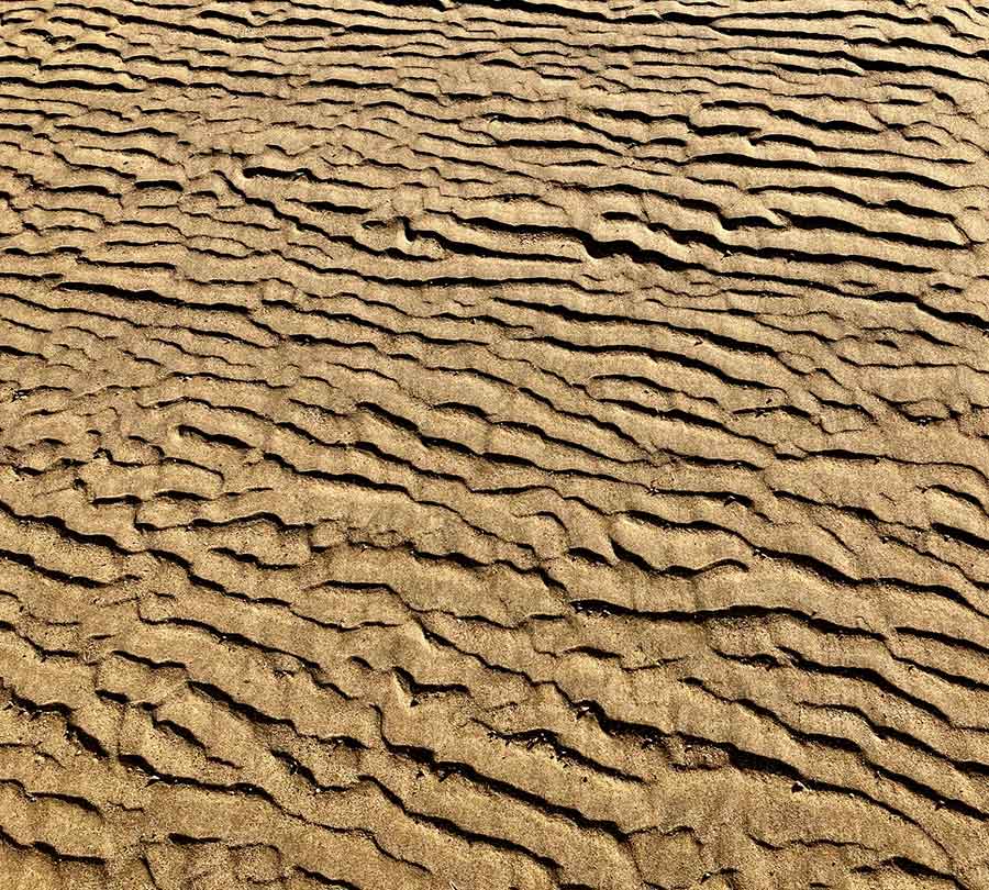
The rocks along the Port Macquarie coast are quite harsh and unfriendly in appearance. They are not foot- or hand- friendly either. Such a contrast with the gentle continuous swell that they edge.
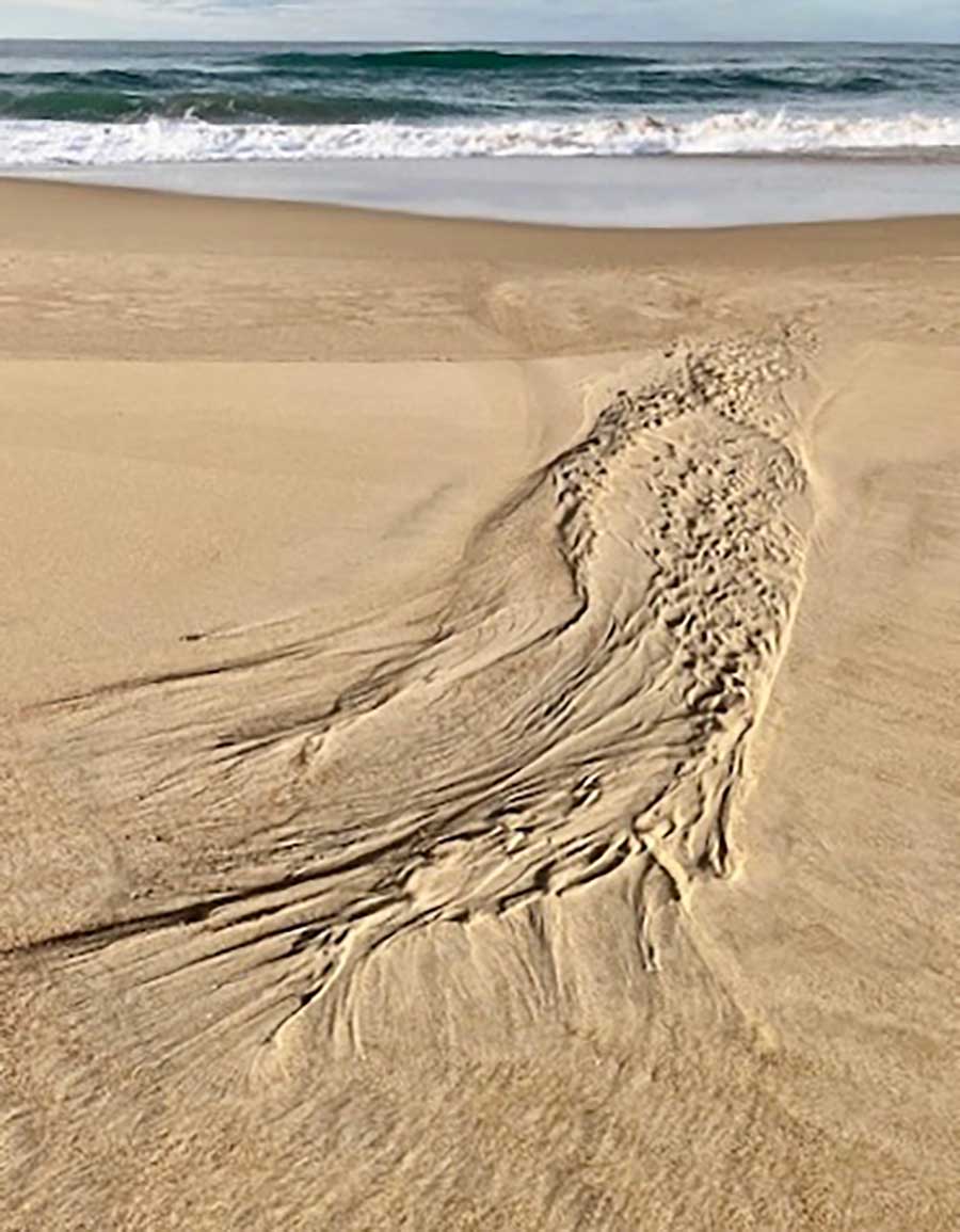
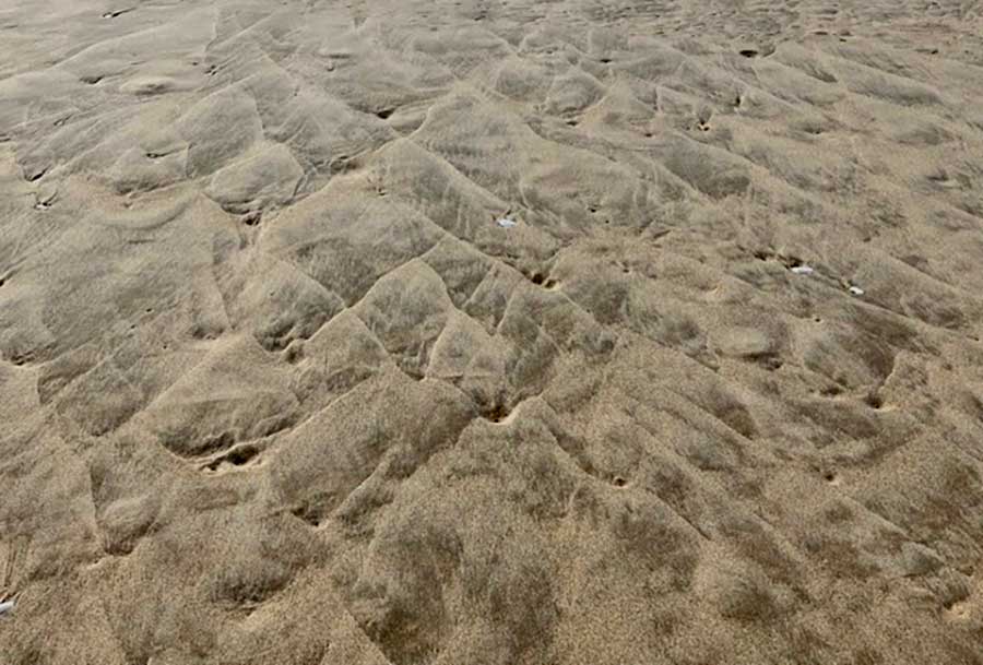
There are many scattered ‘rocklets’ creating lacy patterns and sinuous swirls of their own.
There were very few remnant patterns from the tide, but I don’t know the moods of this beach yet.
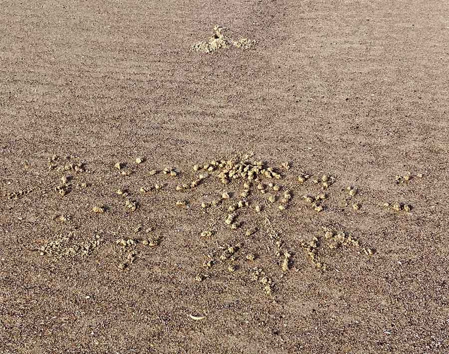
As this cliff and this beach are close to many flats and houses, I wonder about the content of the drips on several rock faces, where the liquid is like caramel topping, not water.
I am pleased to see a healthy banksia with candles all a-glow, but mainly the beach itself claims my attention.
I sit on the edge of a sandbank and admire the tenacious grass runners. Not much evidence of crab activity, as I was used to at Dunbogan but then I am late here today.
It’s not a dog beach. There are just a few determined walkers, doing the length and back.
I feel so relaxed I could sleep on the sand.
Trying to understand why there is such a sense of peace here, I finally get it.
There are no vehicle tracks, no 4WD scourings, just the tidemarks…
My verandah railing was obviously the watching point for feeding time by the previous owners, and the pigeons, brush turkeys and lorikeets took a few weeks to realise that I was not going to be doing the same.
Only the lorikeets have kept trying their luck.
There were hundreds of lorikeets at my old place, noisily loving the paperbark blossoms. But I rarely saw them still and up so close.
Their colours are ridiculously bright and beautiful, compensation for their unmusical screeching.
In the recent wet week, pairs have taken to sheltering on the verandah. While there, they take it in turns to preen each other.
I know it was likely fleas they were after, but it seemed affectionate and charming, to be mutually grooming even when their feathers were somewhat bedraggled and damp.
Well, I am finally fully moved to my new home, albeit with too many things to fit into a much smaller place. The local op shops have received a great deal of the overflow.
I had not had time to check out my nearby walks, which will often be on the coast.
Of course I was first drawn to the closest thing to a mountain: Nobby Head. I read it is only 30 metres high, but it will have to do.
Being an early riser, I hurried up the hill to catch the sunrise, always a miracle.
It wasn’t even 7am, but clearly the dog owners here are earlier risers than I am. The small Nobbys Beach where I had imagined walking was criss-crossed with paw and people prints. There were people busily walking down to it, along it and up from it. Before work, I suppose.
Some had more than one dog.
So the dog beach won’t be my beach.
And I was made aware that Port Macquarie is a much more citified town, as very few folk responded to my ‘Morning’ or my smile.
I climbed up my ‘mountain’, despite a wet and slippery track, much eroded. There is no view from the top, and it does not feel like a mountain, even a miniature one.
I saw other indications of too many people and too little respect for history or nature. The monument at the top was covered in graffiti. It was meant to commemorate Henry Gardiner, who had died in 1874 trying to save a friend’s life in the sea just below here. Both perished.
Where was the respect for them?
The vegetation still held natives like the lilli-pilli I could see, but under so much of the invasive asparagus fern that it was almost buried.
It was all rather sad. I’ll be leaving this beach to the dogs and their dutiful owners. The mandatory and multitudinous pairings struck me as quite odd; what would an alien think of this society?
But I have found somewhere else nearby to explore… and to introduce you to next post.
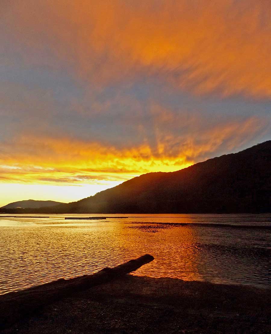
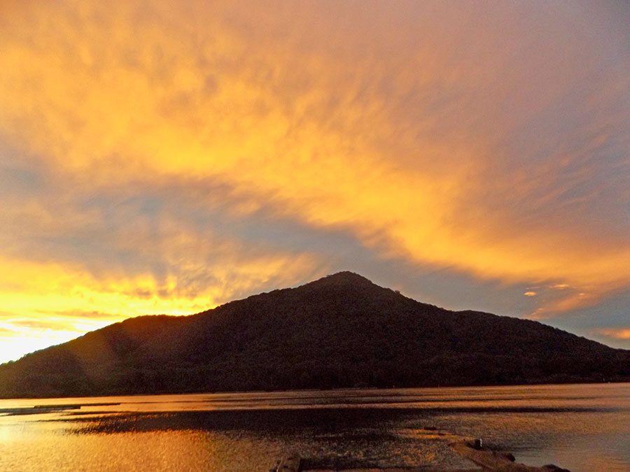
The glory of a very pink sunset and its reflections in the Camden Haven River were a treat. The deep blue additions seemed like punctuation marks.
Although some of that blue cohort seemed more like questing creatures, hurrying forward against that stunning still backdrop bank of pink.
As the colour faded, their southern rush was echoed by a higher golden compatriot, aiming to leap over the blue bars.
Fanciful? Yes, but such an ephemeral show invited fancies. Better than facts at present…
At home the cascades of several varieties of Schlumbergera cacti were showing a fine range of pinks in their abundant flowers, from pearly pales to cyclamen deeps.
I would usually say I don’t actually like pink much, but I applaud these.
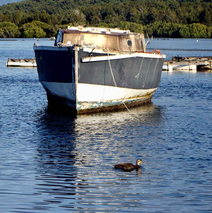
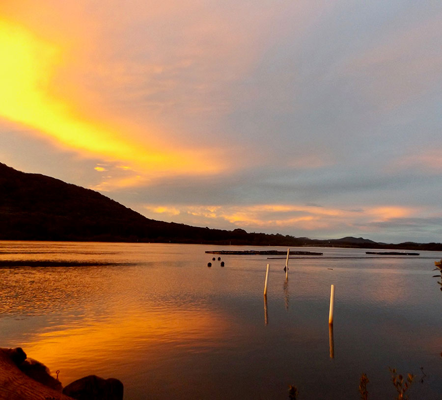
At low tide, the rescued boat is unable to float, sitting askew on the mudflats.
It is early morning and the sky and its gentle colours and reflections take all the attention for the moment. But up close, this slanted and stranded boat offers its name as ‘Wayfarer’. I wonder where it had journeyed as a wayfarer, and if it would again.
Its exposed underside tells me it had sat on the muddy bottom of the river for some time.
Its deck is as colourful as the sky, worthy of contributing to the reflections before the mudflats halt them.
Not that my solo heron minds the low tide; all the better for finding breakfast.
I then learnt that Wayfarer is to be dragged ashore and broken up; she is not salvageable, having sat for about five years on the bottom. Her masts had already been taken down.
My recent walk to the river boat ramp offered the surprise of a new resident: a resurrected boat, muddied and somewhat askew, plainly pulled up from a watery depth greater than it was built to inhabit.
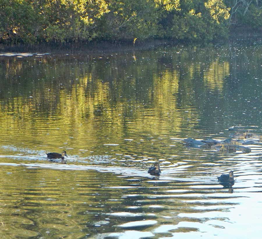
From the mangrove edges the more usual resident ducks were heading out through the reflections and ripples, and creating their own silver trails.
As they passed the salvaged boat I thought how much better adapted they were to this river, to water. It was crippled, useless to do aught but stay afloat: they belonged.
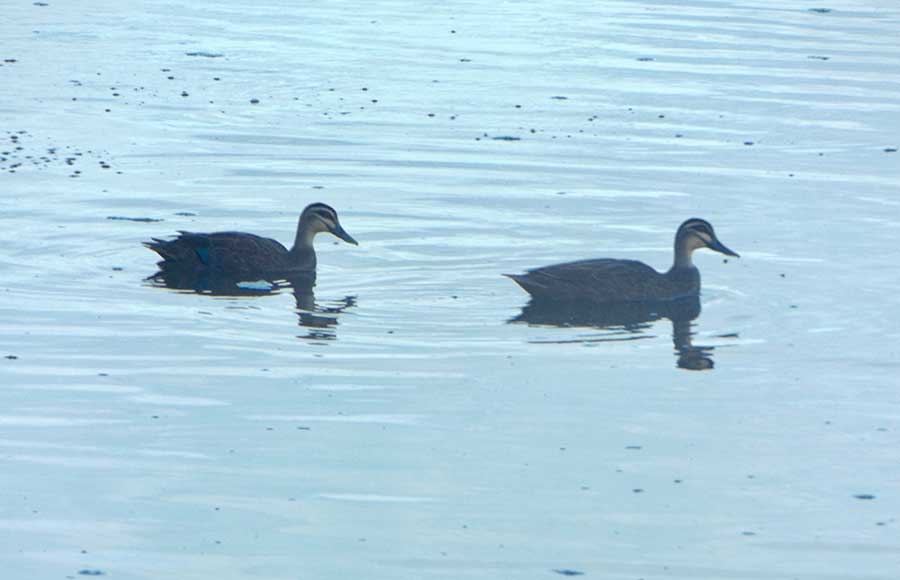
There were actually four of these handsome ducks; I loved the way their reflections paddled with them, double hooked.
I had expected the other inhabitants here to be solo, as was usual. My pelican was indeed the only one on the oyster stacks, but I later realised it had a companion– a shag?
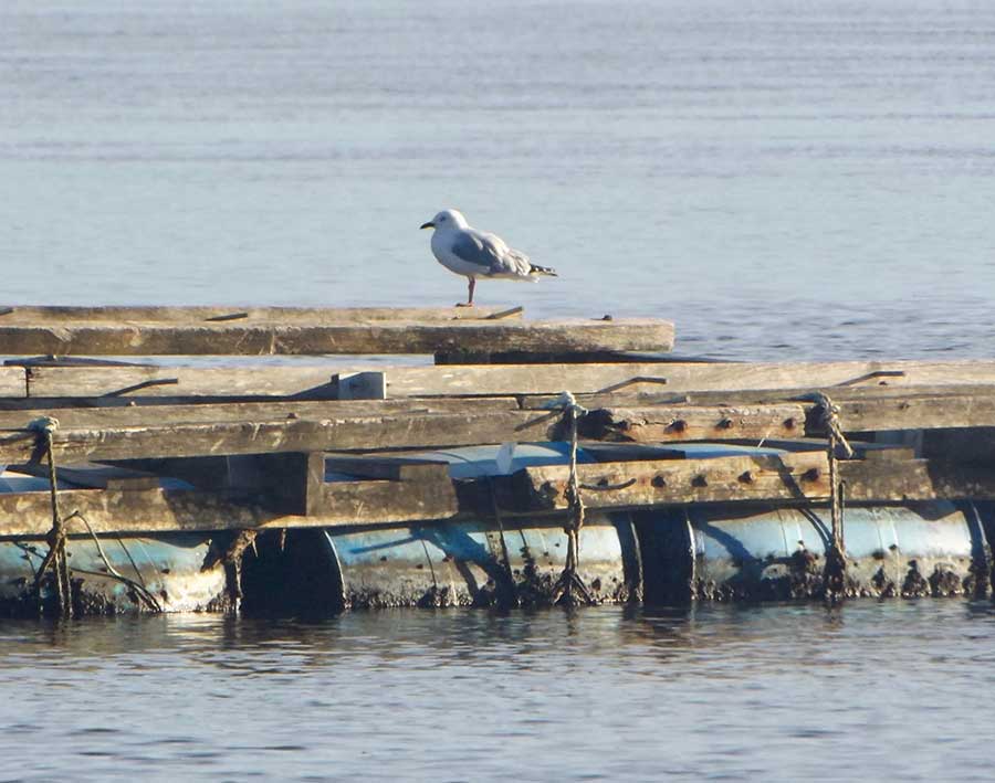
Not sure why I always see solo creatures so often — mirroring me? — but here was my solo seagull, and yes, standing on one leg…
The sole watchful heron picked its delicate way through the exposed mangrove flats as it sought its tucker. And while I have seen more than one seagull or pelican elsewhere, I have not seen multiple herons.
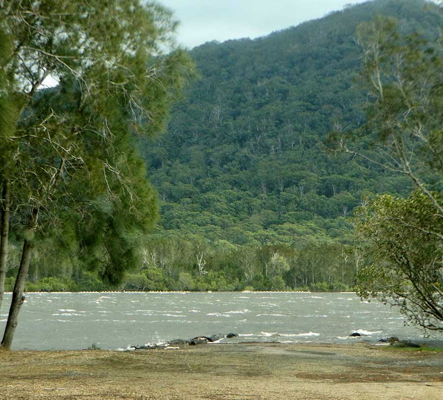
I have taken many photos of Dooragan reflected in the river at all times of day, but to see it reflected in watery mud was new.
As I am moving from here soon, I am relishing all glimpses of the many moods of the river and the mountain…
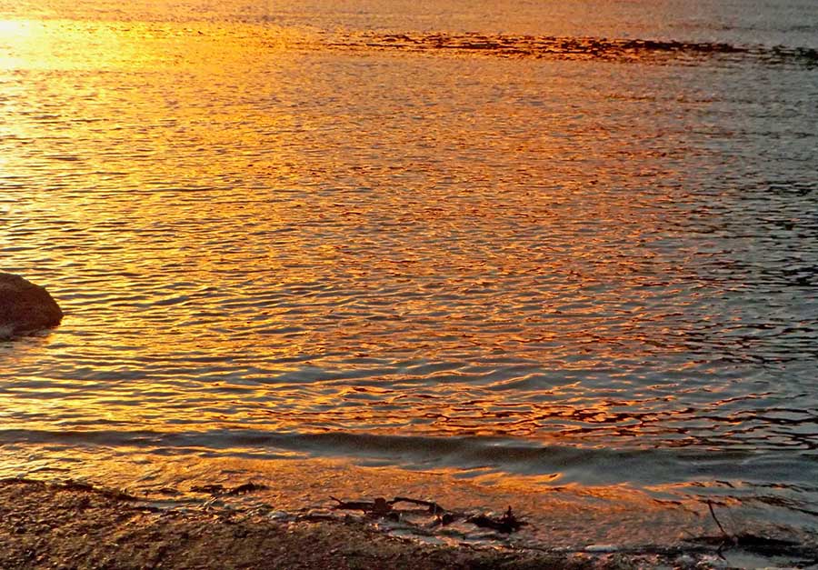
I have never been able to choose between sunsets and sunrises as regards beauty and spectacle; they are so different, and each one of them is different from another.
Autumn is a great season for sunsets, as this rather fierce example shows when I look to the south-west, where the sky seems to be on fire.
But face north and that same sunset takes on more delicate hues.
Face straight ahead to Dooragan and gold lights the sky.
And burnishes the gently rippling river.
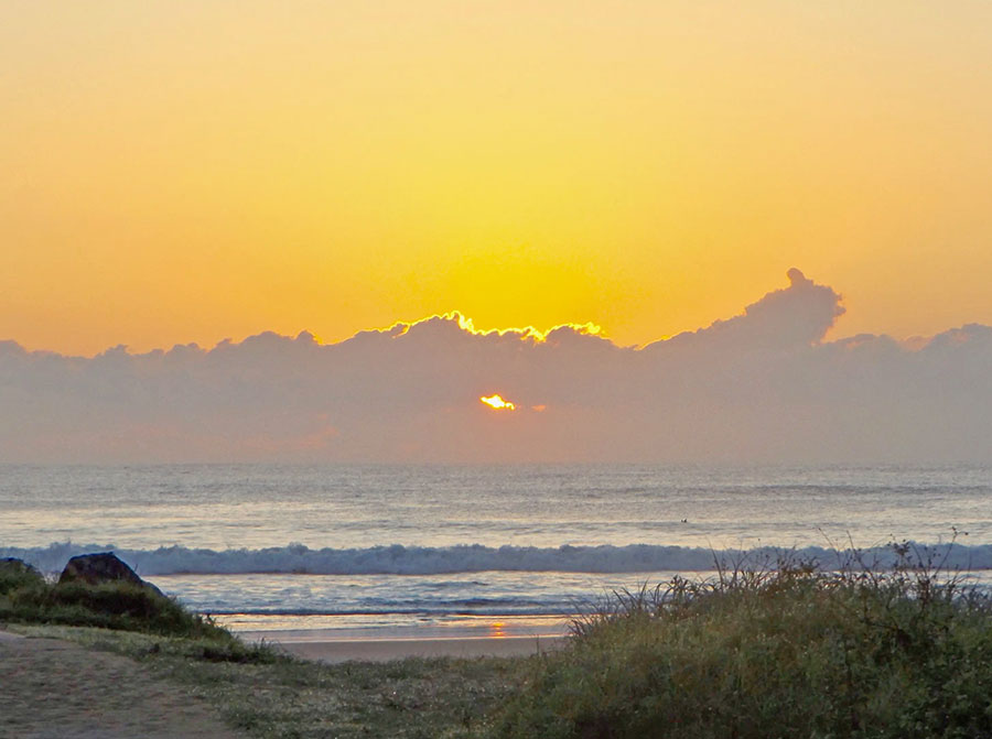
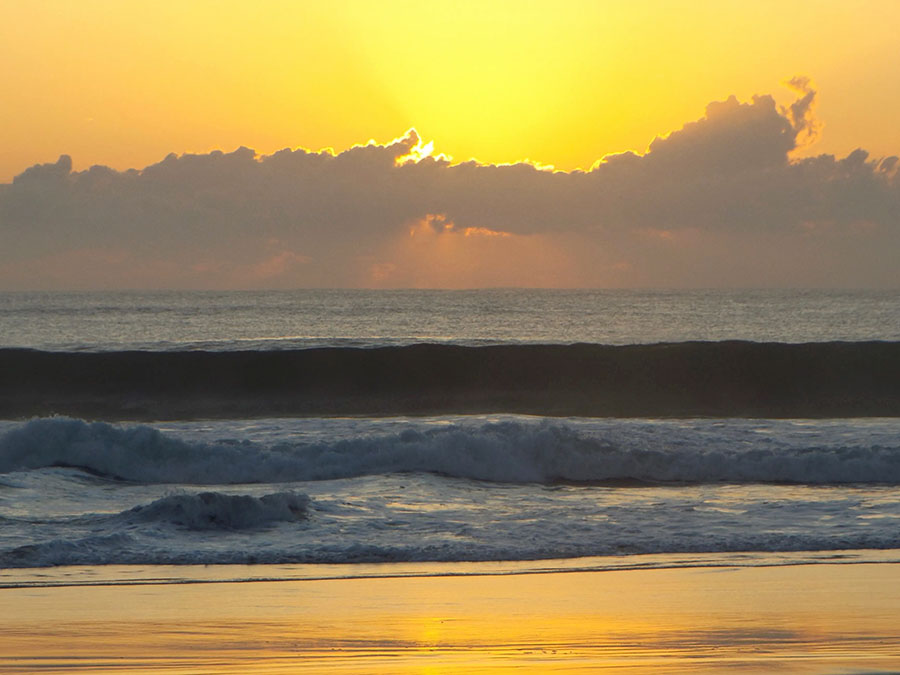
But on the same day the sun had made its entrance with great promise, if less dramatically.
It soon painted the sky and the sand with a glowing peach gold, while the land was struggling to share some of that light.
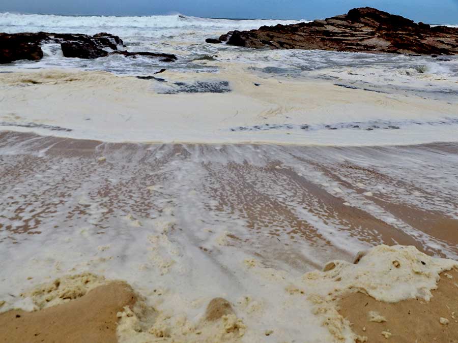
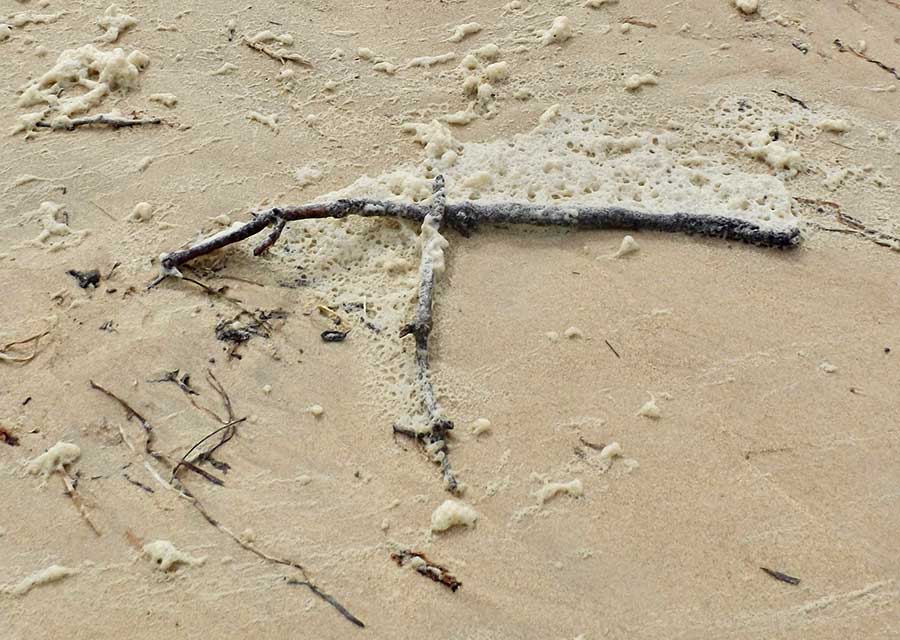
With strong winds sending small branches raining down at home, I could hear the surf thundering in the distance and knew it would be a spectacle.
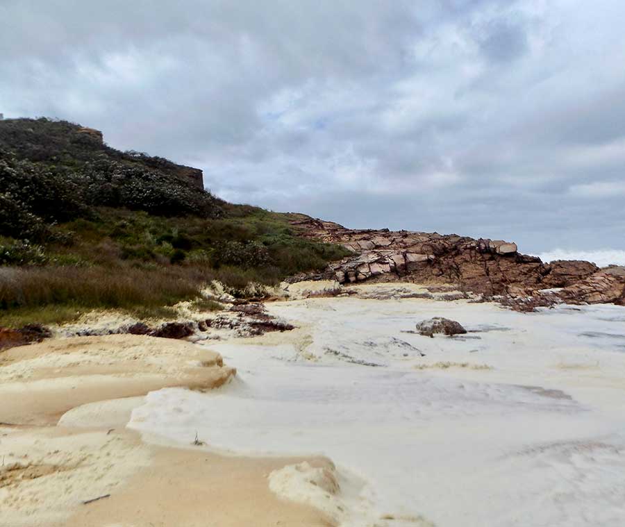
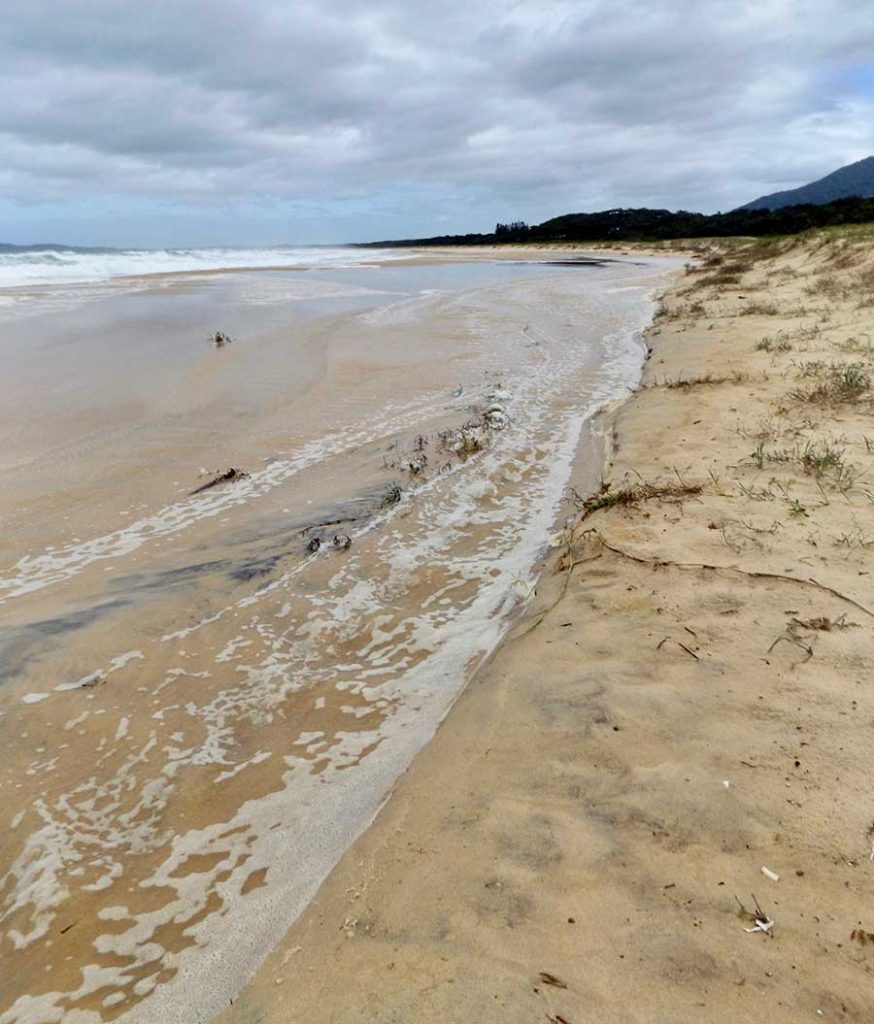
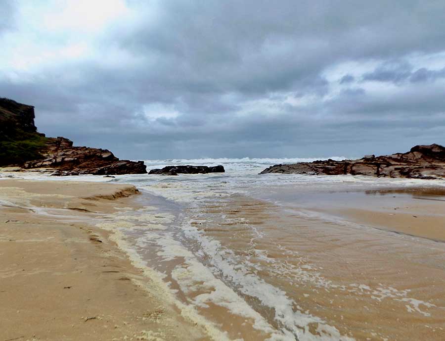
But I hadn’t expected the amount of sea foam that awaited me at the Tuckeroo end of Dunbogan Beach.
The creamy froth had coated the rocks and sand, transforming the usual colour and texture.
The beach itself had been transformed, the high seas cutting into the banks and forging a new rushing stream.
The stream rippled along with each wave, with the yellowish foam edging it like a fancy frill.
Flecks and lines of foam were stranded on the sand, some caught and banked by what the tide had left behind, some blown willy-nilly to roll and dance over the sand.
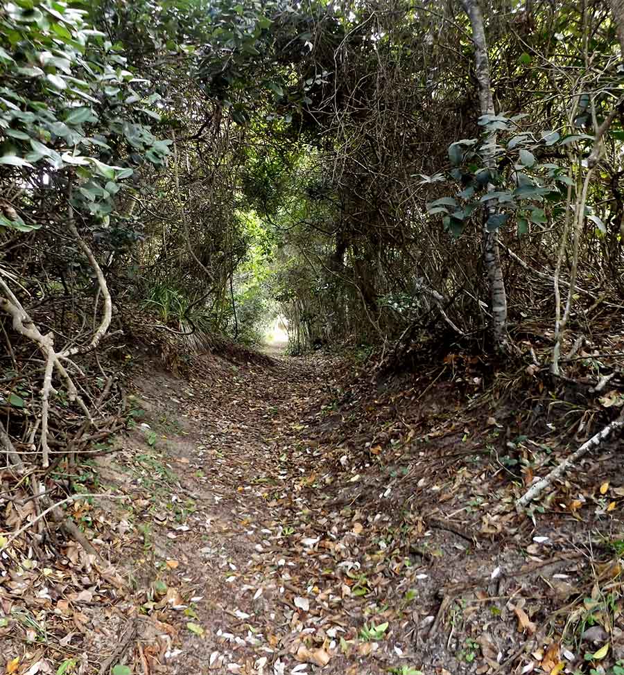
As soon as I entered the dense bush of Kattang to walk back to the Tuckeroo car park, the surf fell silent, and stillness replaced the wild winds.
But if the sea was all white and cream today, in this weather even the Camden Haven River sported whitecaps and waves.
Always worth venturing out in such weather to see what Nature is up to.
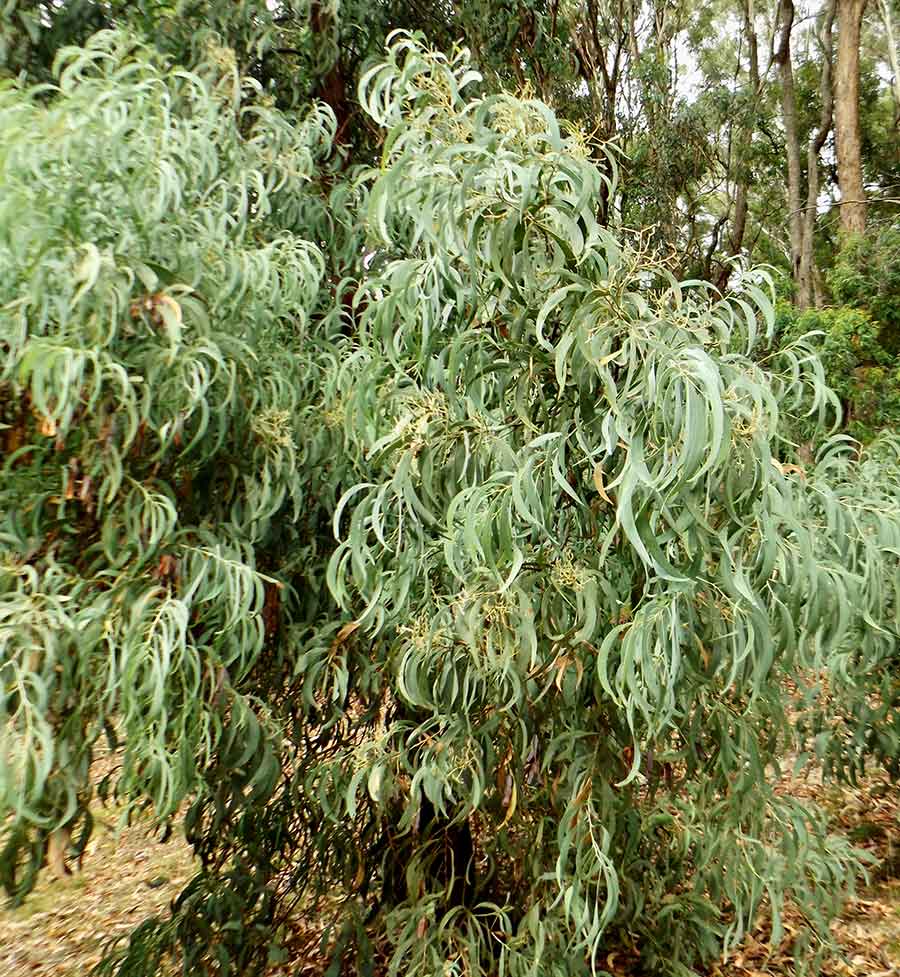
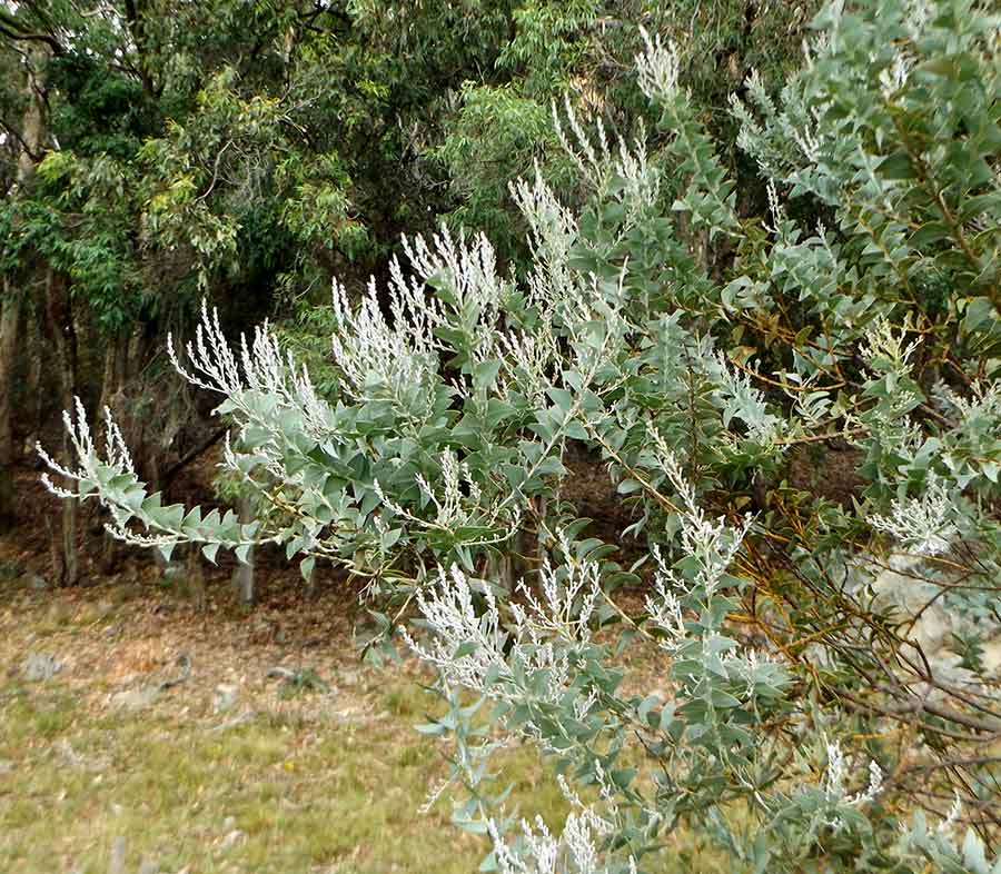
I thought I was looking at gum tree leaves, but in fact it is a wattle — Acacia implexa.
No flowers or seed pods to give me a clue, but what’s in a name with such beautiful leaves?
This decorative and dangly foliage also belongs to a wattle — Acacia vestita.
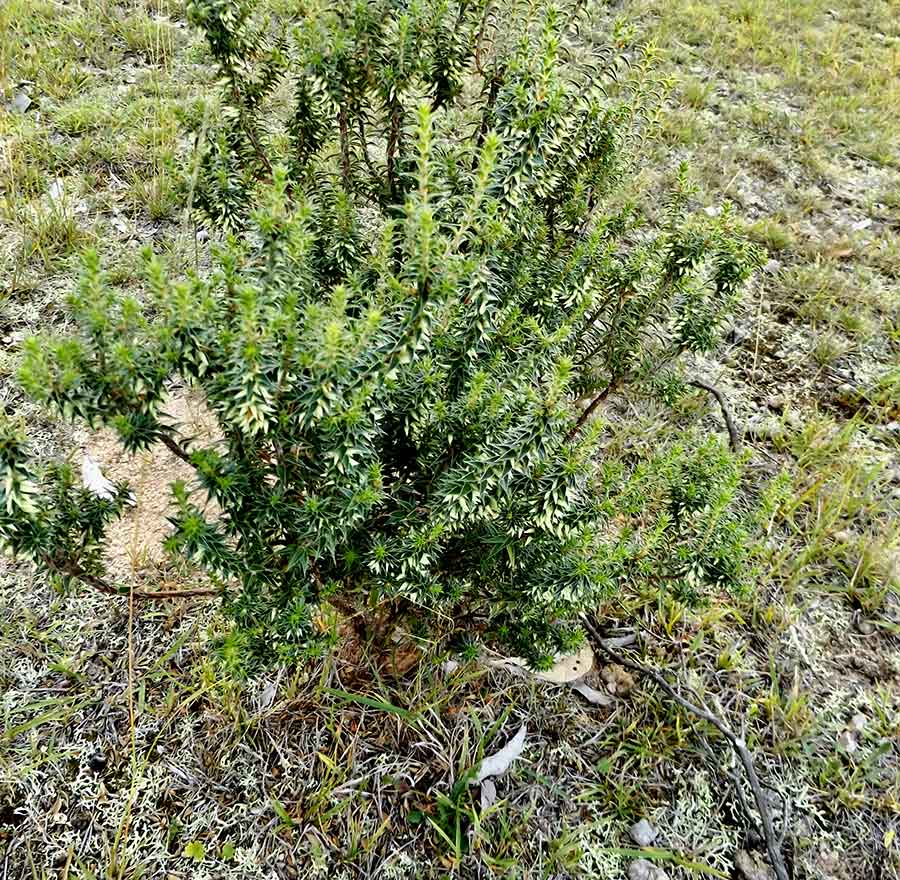
The weird and wonderful triangular leaves on this wattle caught my eye: Acacia cultriformis. New to me.
Not a wattle, but a standout in its solitude as it erupted amongst crackly lichen, is this small shrub of Western Urn Heath, Melichinus erubescens.
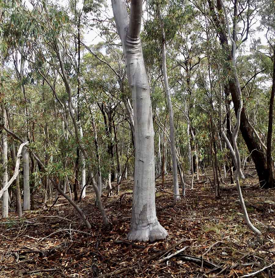
On the ridge top, somehow growing tall and strong amongst rocks, this tree trunk, strikingly silver and grey, presented a single elephantine foot and proud wrinkles as it branched. I am told by my knowledgeable hosts that it is a Scribbly Gum, Eucalyptus rossi.
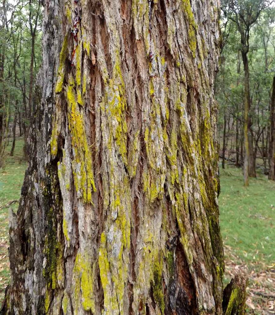
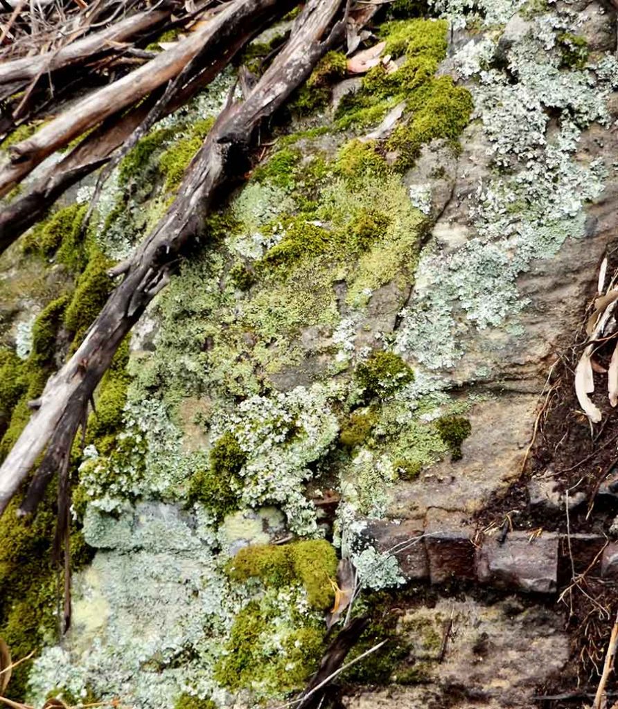
And if a tree does not choose to have a grey or brown trunk, it can opt for green, with a little help from friendly lichen.
For here the realm of green above all belongs to the mosses and lichens, especially after a good rainy period.
They make a fabulous contrast with the bones of this country — the rocks.
Camping simply and self-sufficiently for a week on a friend’s conservation property was partly healing and partly depressing, as it reiterated to me that this is the way I’d rather live.
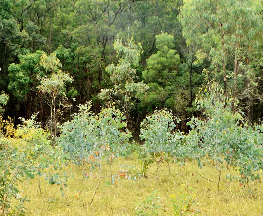
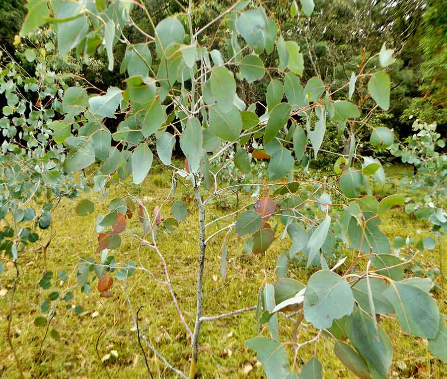
Thousands of trees have been raised from seeds and planted here, but just near me was this self-sown grove of young Red Box, which were actually forming almost a mist of blue-green.
Amongst the blue was a surprising amount of delicate pink leaves.
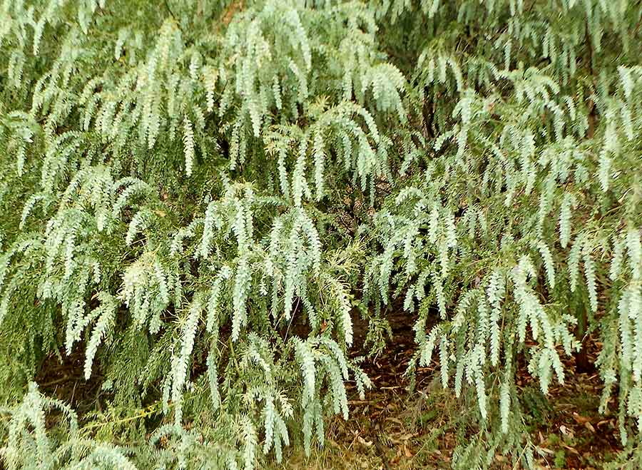
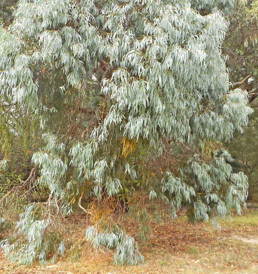
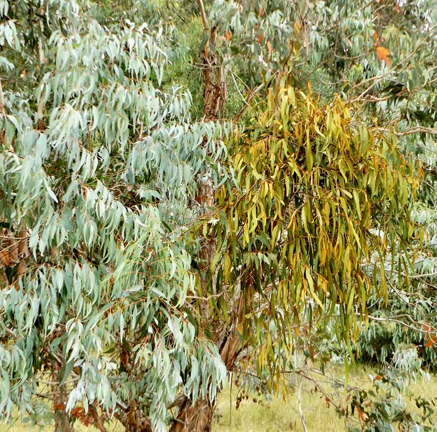
Nearby were stunning trees, Coomber Stringybark, with their pendulous branches of blue leaves. This species is only found in this area west of Rylstone.
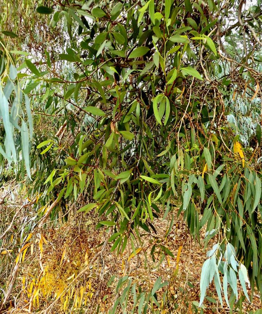
There is a lot of mistletoe here, of several species. Try as it might, mistletoe never quite manages to exactly imitate its host tree’s leaves. Apart from the colour, the shape is pretty close on this Stringybark.
This one is less successful in its mimicry.
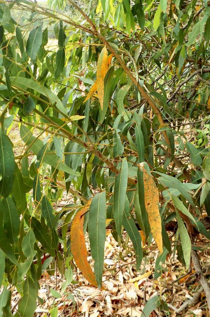
And if the Red Box chooses pink as the perfect colour opposite to vary their leaf colours, the Angophora Floribunda chooses yellow.
So why are children taught to only colour leaves green?