Camberwell – in crisis from coal

In a loop of Glennies Creek sits the historic village of Camberwell: 56 houses, all but seven now owned by Ashton mine — which is Yancoal Australia, which is Chinese company Yanzhou.

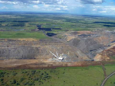
Camberwell is on its last legs. As you can see from the map, the village is all but surrounded by opencut mines.  The Ashton North mine is the closest, just 500 metres away. Life has become almost unbearable there, with the collective noise and dust.

The one aspect still unmined is to the south. Ashton wants to fix that with their Ashton South East Open Cut, immediately across the highway from the main part of the village. 

Recently Planning recommended that the Planning Assessment Commisssion approve the mine.
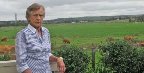
There’s a bit of a problem because half the pit site is veteran battler Wendy Bowman’s dairy farm. Beyond Wendy and her neat paddocks is mine-owned; you can pick it by the weeds and general air of abandonment. The trees and houses to the right is the village, just across the highway; the treeline to the left is Glennies Creek.

Wendy’s already been forced off the family farm once by a coal mine, at Rixs Creek.  She has no intention of letting that happen again, partly because she is desperately worried about what the mine would do to Glennies Creek and its alluvial systems.

Not far south, that creek joins and virtually takes over from the polluted Hunter River, so all irrigators downstream, such as the lucerne-growers at Maitland and the vignerons  at Pokolbin, would be affected.

Planning doesn’t say how Ashton should make her give in, but note the mine is not viable without that property and would not proceed. I shudder to think what tactics, what pressure, might come into play.

Wendy’s not alone in resisting the new mine; the local Wonnarua people are trying to stop the cultural damage it will do, asking the Land and Environment Court  for a 500-metre wide buffer zones around Glennies Creek and Bowmans Creek.
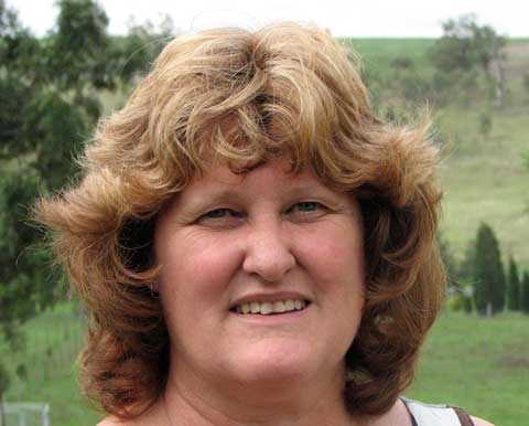
And there’s Deidre Oloffson, who’s been fighting for her village and the right to health of its residents ever since 2002, when Ashton began digging away the back of the hill beside the village. That hill, behind her, used to be the village Common, but the Planning Minister took it away in 2010 for Ashton to use. 

Coincidentally, White Mining, related to Ashton, then applied for an exploration lease over it. Since the Camberwell Common Trust is no longer recognised, Deidre is to fight the government and both miners in the Land and Environment Court, on behalf of the residents, to get their Common back.

She has said all along that this Ashton South East Open Cut will be the final deathblow for Camberwell.

What did Planning suggest to square the mine approval with their conscience?

The seven remaining Camberwell landowners could ask to be bought out if the increased noise and dust got too bad — which it already had and which option they have been refusing — or they could ask to be relocated for the seven years of the mine’s operation. In other words, get out of our way.

Ashton’s tenants have to be warned of the risks, could ask to be relocated too, and everyone had to be given copies of the NSW health fact sheet ‘Mine Dust and You’. Does this absolve Planning and Ashton of blame?

The Planning Assessment Commission is coming to the area for a public hearing, 9 a.m., 6th September, at Glennies Creek Hall. People can have a say there if they register before 31st August with Megan Webb on (02) 9383 2113 or by email.

For details go here and look at the recommendations to the PAC.

All support will be appreciated by the battlers of Camberwell.
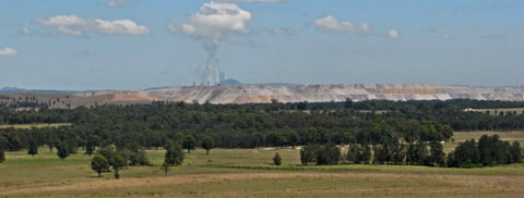
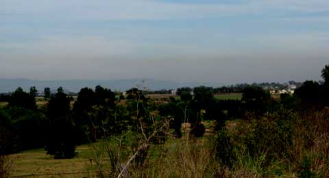
Glennies Creek Hall is on Middle Falbrook Road, reached from Glennies Creek Road off the New England Highway. On the way you get some lovely views back over Camberwell’s surrounding rural environment…
Saving the state

If you think we ought to save some of New South Wales for future generations — rather than hand it out now to coal and coal seam gas companies — you might like to join like-minded people next Thursday and tell the government and the industry just that.

The NSW Government is sponsoring a $900-a-head NSW Mineral Exploration and Investment Conference in Sydney on 18-19 August.

Already 70% of NSW is under coal or petroleum exploration licences; those who will benefit are meeting to share tales of their progress and prospects, no doubt to applaud each other and to commiserate on the nuisances that these protesting communities have become.

I couldn’t see it on the agenda, but I’ll bet they share strategies over drinks for ‘managing the outrage’. Many of us are outraged that government still allows mining projects to over-ride the wishes of communities (like Camberwell), damage environments (like the Pilliga), threaten productive land (like Caroona) and precious water (like just about everywhere!).

All the heavies will be there; Thursday is about exploration, so Coalworks, AGL and Santos feature largely. Government and industry need to be told that we would prefer they conferred on how to save the state from rampant fossil fools, and think of the future instead.

The Lock the Gate Alliance is organising an alternative conference outside the venue — a conference for food, water and communities.

They are inviting community groups who want a different future to come to Sydney and present the other side of the impacts of mining. (I’m sure they mean individuals too.)

What: Rally at the NSW Mineral Exploration and Investment Conference 2011

Where: Sofitel Sydney Wentworth, Phillip St., Sydney
?
When: 12 noon, Thursday 18 August

Speakers include:

  • Jess Moore: Stop CSG Illawarra
  • Tim Duddy: Caroona Coal Action Group
  • Bev Smiles: Mudgee District Environment Group
  • Peter Martin: Southern Highlands Coal Action Group
  • Jane Judd: Friends of the Pilliga
  • Mark Ogge: Beyond Zero Emissions
  • Jeremy Buckingham: Greens MLC
  • Rising Tide Newcastle
  • Drew Hutton: Lock the Gate Alliance

For more information email Lock the Gate

Register at the Facebook Event

Visit the Lock the Gate Alliance Website

Conference agenda

Get counted for Acland

Many of you will have heard of Acland, the Queensland town almost erased by New Hope Coal for their New Acland Mine Stage 3. It’s not even approved yet but they have bought up the town and emptied it out.

A few scraps not worth selling off or not movable show where once where houses — and people.

Only one landowner, Glenn Beutel, remains.   See my past post, Acland, death by coal.

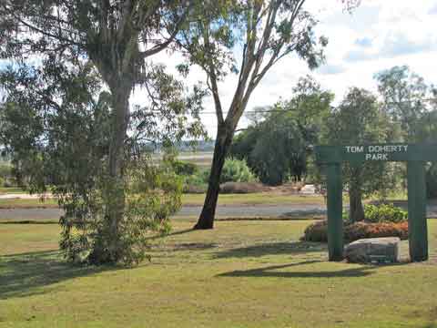
The Park and whatever Glenn owns are still cared for by him; they look loved and used by people. There’s a war memorial in the Park, but just across the road the concrete slabs and garden edges are poignant memorials to past villagers.

All of you will know that next Tuesday, 9th August, is national census night.  Brisbane Friends of the Earth’s climate action arm, Six Degrees, has come up with a great idea to ‘repopulate’ Acland.

They are inviting any and every one to join them in spending census night in Acland to show the government that people prefer community to coal.

Where: intersection of Acland Road and Francis St, Acland

?When: Tuesday 9 August from 6pm

?Bring: a plate of food to share for dinner, camping gear and warm clothes

(Any questions or if you’re driving and have a spare seat or need a lift, please email Shani

So if you live anywhere in striking distance (it’s not far north of Toowoomba) or are passing through, why not stand up (or lie down) and be counted for Acland — in Acland — on Tuesday night?  Say ‘Hi’ to Glenn for me if you do.

Blackening the Golden Triangle

In Central Queensland there is a cropping area south of Emerald that’s so rich and reliable it’s called the Golden Triangle. It takes in the towns of Orion, Springsure, Gindie and Rolleston, and supports a population of farming families with an atypically young average age.

You’d have said it had a golden future.

With exceptionally reliable rainfall and deep black soils that grow sorghum, wheat, sunflowers, mung beans, navy beans, chick peas or cotton, any property that goes on the market round there is snapped up at once. Or used to be.


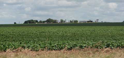
An Orion farm

Since Bandanna Energy laid its exploratory coal paws on this region, with their Springsure creek and Arcturus projects, nobody would touch it.

The Golden Triangle group has lobbied hard since 2009 to save their region and their livelihoods. When I visited, I saw how well-cared for and prosperous all the farms were on this flat flood plain; this was bleedingly obvious prime land.

Everyone was holding out hopes for the Queensland Government Strategic Cropping Land (SCL) Policy, then in draft form. If anywhere fitted the bill for protection, surely the Golden Triangle would.

And when the final criteria came out, much of it did. BUT only for new or less advanced projects; easier transitional arrangements would apply to coal projects that had submitted their final EIS terms of reference by 31st May.

Bandanna hadn’t, which gave hope to the farmers, but after some hard private lobbying, on 7th June it was announced that ‘a specific legislated transitional framework would apply to the Springsure Creek Project, green-lighting its potential development as an underground coal project, despite its identification as being some of Queensland’s best cropping land.’

But not to worry, as in published Letters to the Editor (QCL 23/6/11, CQ News 24/6/11 et al), Treasurer Andrew Fraser and former minister Kate Jones state “It is important to note that these transitional conditions were granted to the Springsure Creek project only after Bandanna Energy provided a written assurance that the project would not permanently damage strategic cropping land.”

How can they say this with a straight face?

The group intends to fight even harder against such shortsighted insanity in a world needing food and water security far more than Bandanna needs its coal dollars. They now have their own website, (to be a permanent link from mine) so please visit for more information or to give support.


Xstrata’s Rolleston Mine (photo courtesy of the Tysons)

Across the highway, where Avriel and Lindsay Tyson’s ‘Springwood’ is under serious threat from Xstrata’s Rolleston mine (see post ‘When the neighbours get pushy’), another productive farming property has fallen to Xstrata.

On 23 July Avriel emailed that their near neighbour, Meteor Downs, one of the original Springsure district properties — ‘a beautiful old established property’ with lots of history and ‘43,000 acres of good country’ had just been sold by the by AA company to Xstrata – for $21.6 million.

‘So, so sad,’ says Avriel.

I couldn’t agree more. Where will it end, and who will stop these cashed-up and government-favoured mining companies gobbling up our land, our history and our future? No state government for sure.

Sandstone geometry

In my last week at Goulburn River Stone Cottages I was taken on a walk up the Gorge towards the famous Drip, approaching it this time from the opposite direction.

This took us past giant jumbles of rocks, some midstream like beached battleships, others landed on their sides not far from the cliffs that had let them go.

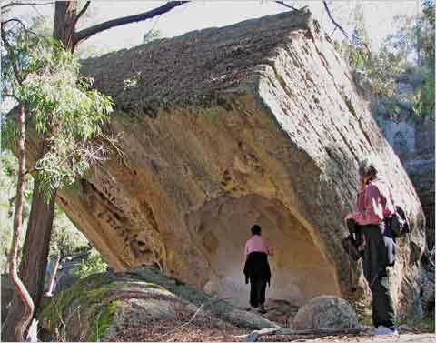
I was astonished at the amount of very straight lines, as in the edges of pools, or the mighty sharp-edged slab, a stone lamington with a nibbled-out underside. (Photo by Robert Bignell)

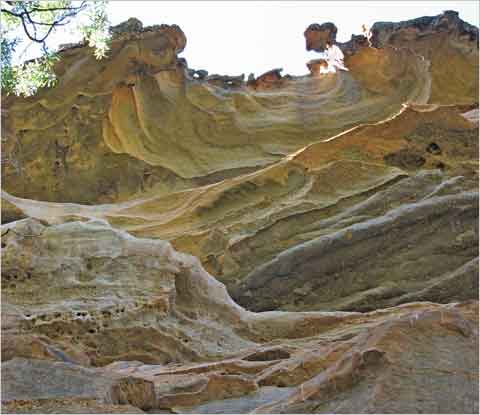
But there were equally amazing rounded shapes, curves in cut-outs, rolls, loops and overhangs, and extraordinary suspensions, created over eons. None are meant to cope with the shocks of underground mining.

China has impressive gorges too; as they don’t have the world’s best environmental record, I wonder if they plan to undermine close to them, as they do here at their Moolarben coal project, owned by Yanzhou.

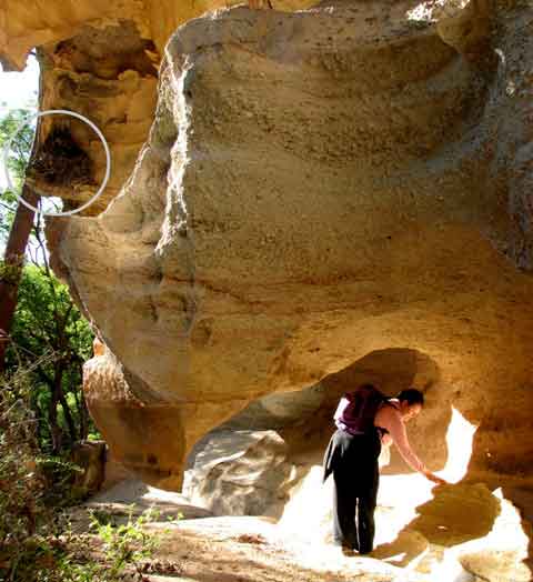
In this spectacular overhang, being inspected by my friend Gail Bignell of The Old Brush there’s a Lyrebird’s nest (circled) tucked up on a shelf. (Photo by Robert Bignell)

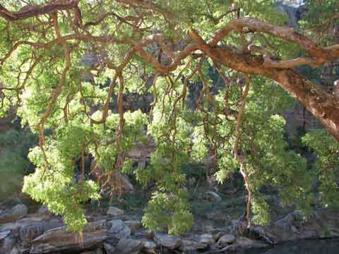
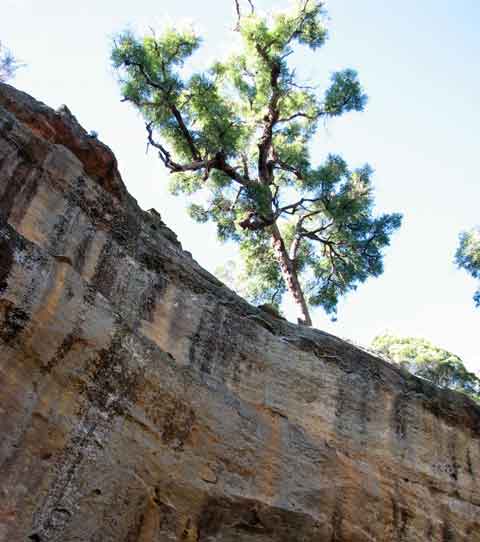
But the large old Angophoras that fringe the gorge rival the rocks in curves and add the grace of their dangling branches and leaves. As we sat under this beauty for our picnic, lulled by the river burbling past below, the peace was broken by the cries a pair of Peregrine Falcons, who flew out from their nest in the cliff opposite to chase off a Wedge-tailed Eagle.

What a special, special place.

River walking

North of Mudgee, the Goulburn River flows to meet the Hunter at Denman. This river has cut spectacular gorges and created world class natural wonders, as at The Drip — see my post about it, ‘Natural treasures.’

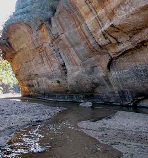
It flows through the Goulburn River National Park and some lucky private properties. I stayed at such a one — Stone Cottages — and went for a walk downriver.

At present the river here is a gentle and mainly shallow thread through sandy beaches, but I could see by the debris in the arching Angophora trees and the flattened vegetation on some banks that it knew how to assert itself when given the rainfall. But in the week the Hunter and the north coast were flooding, here we received only 5mm.

Walking down this river means that every now and then you strike giant cliffs like this one, Wave Rock, towering above the river bed. At such places you run out of beach and either wade across or climb over the top. I opted for wading after the first failed attempt at jumping. Wet boots are wet boots!

I wished the ancient Angophoras watching from the clifftop could speak of the sights they have seen over time.

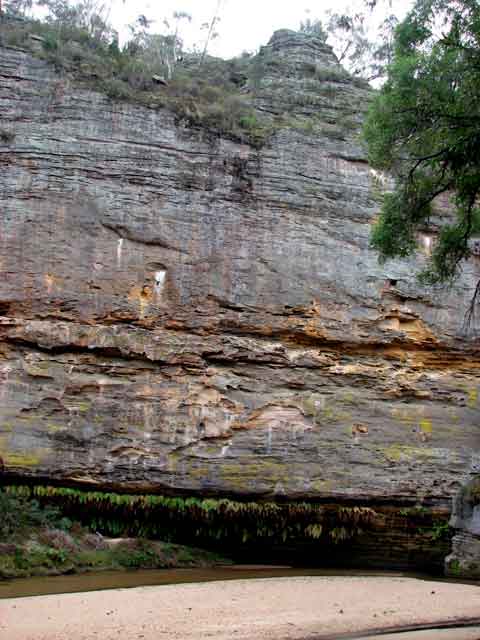
On the northern side of the river the cliffs became more striated, almost tesselated in places, and pocked with holes large and small, clearly used by perching birds.

The rugged clifftops looked like pagodas in the making, as in the famous Gardens of Stone near Lithgow, now needing protection from coal mining. You can help by signing the Protect the Gardens of Stone petition.

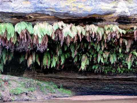
Where the river had undercut the cliff, a mini-Drip had been established, watering a sheltered hanging garden of rows of ferns.

These are just a few of the natural treasures of these gorges, at future risk from Moolarben’s longwall underground mining. Overhanging cliffs and cantilevered rock shelves may wear away over eons, but they aren’t going to cope with the sudden removal of the strata below, as already seen in the Lithgow region and graphically documented in The Impact of Coal Mining on the Gardens of Stone by Keith Muir of the Colong Foundation for Wilderness. Download the PDF here.

And for what? Profit for Chinese company Yanzhou.

The march of the methane-mongers

As the gas leaks and bubbles, and the contaminants creep into the falling water sources and the salt accumulates, as people itch at strange rashes, hold their heads with strange aches, or their stomachs with strange nausea attacks, and worry if they are drinking cancer-causing chemicals from the fracturing process or breathing them in from the gas flares — the coal seam gas (CSG) industry continues to advance across Australia. Gasland is here. This is Angus Bretherick, 6, with the rash his family say was caused by their local coal seam gas industry. Angus lives at Tara, hotspot of the Queensland methane push, and where residents had been complaining since 2008 about leaking gas wells and the dumping of CSG water on roads. (Photo: Courier-Mail 21.10.2010)
The Gasland film showed impacts of the coal seam gas and shale gas industry in the U.S. It put ‘fracking’ into all our vocabularies.

We have CSG rapidly spreading now; they are investigating shale gas, which always needs fracking, in three states. They want it all, in whatever strata the methane is hiding – for export, and ‘they’ are mainly foreign companies.

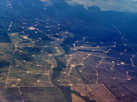
40,000 wells like these at a Chinchilla (Queensland) gas field have been approved in that state; the net of wells and linking roads and pipelines over the Darling Downs is more dense and more extensive now, a year later.

They can do this on your property; can you then imagine, as they claim, that CSG and farming can co-exist?

Read more

Dark skies

A storm-bent early morning, when pewter clouds fill the western horizon and no scrap of blue to be seen.

The sun climbs over my eastern treeline and switches on the spotlight, and the contrast between the suddenly vivid green moptops of the gum trees and that heavy background sky sends me running for the camera.

Blue is not the only beauty a sky can offer.

But that’s in Nature’s own colour scheme. Let  corporate Man at it, and brown enters the palette. Dirty brown, pollution brown, ‘don’t breathe-the-air’ brown, the cumulative emissions from too many open cut coal mines and coal-fired power stations. Accepted as hazardous to human health in the U.S., still unacknowledged here — that would mean they couldn’t approve any more. 

Lucky we have different lungs from Americans.

Welcome to the mid-upper Hunter Valley, which I can remember once had clean country air, blue or grey skies, but no toxic stripes of brown.

Minimal mining impact

Up near Capella, north of Emerald in Queensland, cattle farmers Mick and Margaret Shaw took on the Kestrel mine, objecting to Pacific Coal (Rio Tinto) wanting surface rights to mine under part of their mining lease, which extends over a fifth of the Shaws’ cattle property. 

They had seen the results of longwall mining under a neighbour’s property — cracking, subsidence, water running the wrong way. Their objections were dismissed by the Land and Resources Court; they appealed and won, since it was found that ‘the mining lease contained a fatal flaw, a technical error that made it invalid in relation to the Shaws’ land’. 

But then the Queensland Minister for Natural Resources said:

“The State’s interests in extracting its minerals resources for the benefit of the people were at risk” and so ‘they granted the company surface rights, not just to the small portion it had originally applied for but to all of the lease area on the Shaws’ land’. (ABC 7:30 Report 14.8.2002)

The Shaws felt this would make their property unviable, and the company should buy them out. But, as always, the company assured the government that the level of subsidence here would be ‘minimal’.

Local organic farmer Paul Murphy showed me that rollercoaster of a road at the top of this post, which demonstrates the ‘minimal subsidence’, 12 years after mining; two-metre deep dips — still sinking and constantly being repaired…

…and one other visible impact of those old longwalls — bands of dying established trees over the 265-metre longwall bands but not over the 30-metre gaps in between.

The mine owns most of the land now and leases it out, and I suppose they’d say that this most un-idyllic pastoral scene proves that agriculture and mining can co-exist.

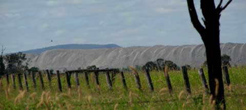
Of course, if people complain about underground mining, there are plenty of old overburden dumps left unshaped and unrehabilitated — in which Queensland abounds — for them to refresh their memories and choose which they found least invasive. There is never a choice for neither.

Don’t breathe the air

The once-rural Hunter Valley baked in the early February heatwave, but not under blue skies. The many and expanding open cut coal mines in Singleton and Muswellbrook Shires made sure of that. This was what the air quality looked like on Friday 4th February.

On the Tuesday before, the 1st February, the averaged PM 10 reading was ‘very poor’, exceeding national health standards where ‘people with heart or lung disease should limit exercising outdoors’.

We are told that local dust emissions could be reduced by half if best practice particulate emissions controls were put in place, and if there was ‘a substantial increase in the area of land rehabilitated each year and the application of suppressant to haul roads’.

Given the known health issues from dust particulates, why don’t they do this already? It would cost money, cut into profits.

Why aren’t they told to do it or shut up shop?

Surely not because it would displease donors, cut into royalties?

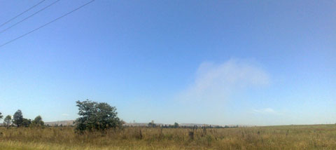
A friend sent this snap, taken from the road, of dust rising from the massive Mt Arthur mine at Muswellbrook, about two weeks ago. A common enough sight to those who live in the two shires, when passing any of the mines.

And yet the state government has just issued its NSW Coal and Gas Scoping Paper, where the scary assumptions are made that, rather than agree that these shires are over-saturated with mines and dust and power station emissions– they will get more.

‘The intensification of mining in the area between Singleton and Muswellbrook will require the careful management of potential cumulative impacts in an area that already accommodates substantial coal mining activity.’

The words say it all about the disconnect from the dangerous and dirty reality: ‘potential’? ‘accommodates’? ‘substantial’?

So we are not to worry, because it will be ‘managed’ as it is now, no doubt under equally strict consent conditions as now, since, as we are always told, the mining industry is the most highly regulated of all.

Comments are invited from the public until 15th April. Please have a read of what I consider an offensive draft blueprint for a coal-trashed future for NSW — it’s not very long — and let them know what you think!

Download it here: Coal and Gas Scoping Paper

Coal floods?

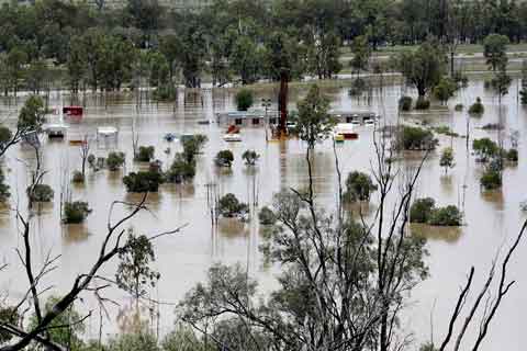
As central Queensland floods, I am hearing much in the media about the economic damage to the coal mines there, but not what those mines are contaminating as the floods surge through them. Or as the exposed coal stockpiles at every mine, rail loader and port loader wash into the floods.

 When the town of Theodore was evacuated, I immediately thought of the flatness of the country and the road to Theodore, which runs for kilometres beside the Moura mine’s heavy metal-laden overburden dumps, now washing into the rushing flood, and of their contaminated mine water, usually stored in earth-walled tailings dams.

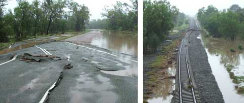
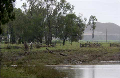
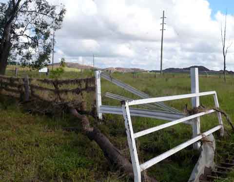
And if you ever thought road and rail were solid things, just look at how they have been pushed aside by  water — lifted like frosting on a cake, as shown by this photo of the Banana to Theodore route, passed on by Avriel Tyson from near Rolleston.

What will such power have done in all the mines up there?

In previous floods, such walls have broken or been overflowed, and mines fined (tuppence!), as at the Ensham and Rolleston mines in the Emerald region, for releasing these toxic waste waters into the river system — and hence to the Great Barrier Reef. This photo, of the Rolleston mine flooding in that previous event, was taken by Avriel Tyson.

The Tysons have been isolated on their homestead island of slightly higher ground (which I had thought was flat when I was there) by the current unprecedentedly high flooding since late December, creeks breaking their banks that never have before, their road washed away — one of their heifers turning up 20 kilometres away! — and they are told that the next-door mine has had two metres of water over its railway line. 

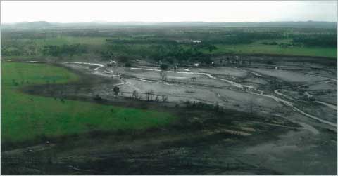
As the waters dropped, Avriel took photos of flooded Sandy Creek near their boundary, with the Xstrata mine behind.

Tysons have been here for over 100 years but Avriel says that this is a first; that the normal flood direction is baulked by the mine’s ‘ring tank levees and overburden piles’.

She wonders what the mine is doing with its water, and, looking at the debris on the fence and grid at their boundary with the mine,  I too wonder what invisibles the mine has deposited.

Farmers expect to work with flood plain systems, mines can’t.

There are about 40 mines in the Bowen Basin, many of which interfere with the natural spread and flow system of floodwaters, their massive earthworks blocking and channelling so the plain no longer functions as nature designed.

In the Surat Basin, increasingly sieved with a network of gas wells and test bore holes — Taroom, Chinchilla, Dalby — what will the aftermath damage be from all the submerged and tumbled drilling sites and pipelines? The photo above, passed on by Avriel, is on the Taroom/Roma road.

 Mine management ‘plans’ for hazardous materials and wastes may tick the government boxes for approval but they only work on paper, not on the flood plains. Thirty more mines are planned for the Bowen Basin in the next five years, and half of the existing 40 are expanding.

Poisoned river systems, poisoned silt deposited on farmland?  We need to hear from the mining industry how they are dealing with this aspect of multliple flooded mines, not just how it will hurt their profit margins.

All creatures…

On the first day of the new year, 2011, I choose to feature one of my smallest fellow residents, found lazing in a hydrangea flower.

And I think how lucky he is to live in a protected habitat where only his natural enemies can affect his life.

Yet even in a gazetted Refuge and with a conservation contract on my deeds in perpetuity, were there coal under us, nothing would protect him or me from mining. Coal does not follow the same laws as the rest of our land users.

And that has to change.

Coal needs to be deposed as King in this country.

My New Year resolution is to keep working to make that happen.