Get counted for Acland

Many of you will have heard of Acland, the Queensland town almost erased by New Hope Coal for their New Acland Mine Stage 3. It’s not even approved yet but they have bought up the town and emptied it out.

A few scraps not worth selling off or not movable show where once where houses — and people.

Only one landowner, Glenn Beutel, remains.   See my past post, Acland, death by coal.

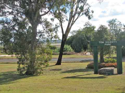
The Park and whatever Glenn owns are still cared for by him; they look loved and used by people. There’s a war memorial in the Park, but just across the road the concrete slabs and garden edges are poignant memorials to past villagers.

All of you will know that next Tuesday, 9th August, is national census night.  Brisbane Friends of the Earth’s climate action arm, Six Degrees, has come up with a great idea to ‘repopulate’ Acland.

They are inviting any and every one to join them in spending census night in Acland to show the government that people prefer community to coal.

Where: intersection of Acland Road and Francis St, Acland

?When: Tuesday 9 August from 6pm

?Bring: a plate of food to share for dinner, camping gear and warm clothes

(Any questions or if you’re driving and have a spare seat or need a lift, please email Shani

So if you live anywhere in striking distance (it’s not far north of Toowoomba) or are passing through, why not stand up (or lie down) and be counted for Acland — in Acland — on Tuesday night?  Say ‘Hi’ to Glenn for me if you do.

Blackening the Golden Triangle

In Central Queensland there is a cropping area south of Emerald that’s so rich and reliable it’s called the Golden Triangle. It takes in the towns of Orion, Springsure, Gindie and Rolleston, and supports a population of farming families with an atypically young average age.

You’d have said it had a golden future.

With exceptionally reliable rainfall and deep black soils that grow sorghum, wheat, sunflowers, mung beans, navy beans, chick peas or cotton, any property that goes on the market round there is snapped up at once. Or used to be.


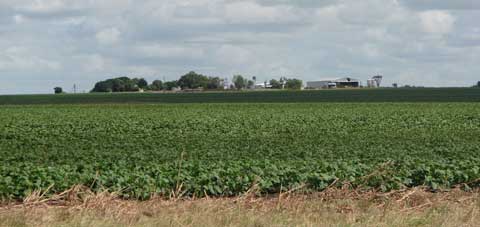
An Orion farm

Since Bandanna Energy laid its exploratory coal paws on this region, with their Springsure creek and Arcturus projects, nobody would touch it.

The Golden Triangle group has lobbied hard since 2009 to save their region and their livelihoods. When I visited, I saw how well-cared for and prosperous all the farms were on this flat flood plain; this was bleedingly obvious prime land.

Everyone was holding out hopes for the Queensland Government Strategic Cropping Land (SCL) Policy, then in draft form. If anywhere fitted the bill for protection, surely the Golden Triangle would.

And when the final criteria came out, much of it did. BUT only for new or less advanced projects; easier transitional arrangements would apply to coal projects that had submitted their final EIS terms of reference by 31st May.

Bandanna hadn’t, which gave hope to the farmers, but after some hard private lobbying, on 7th June it was announced that ‘a specific legislated transitional framework would apply to the Springsure Creek Project, green-lighting its potential development as an underground coal project, despite its identification as being some of Queensland’s best cropping land.’

But not to worry, as in published Letters to the Editor (QCL 23/6/11, CQ News 24/6/11 et al), Treasurer Andrew Fraser and former minister Kate Jones state “It is important to note that these transitional conditions were granted to the Springsure Creek project only after Bandanna Energy provided a written assurance that the project would not permanently damage strategic cropping land.”

How can they say this with a straight face?

The group intends to fight even harder against such shortsighted insanity in a world needing food and water security far more than Bandanna needs its coal dollars. They now have their own website, (to be a permanent link from mine) so please visit for more information or to give support.


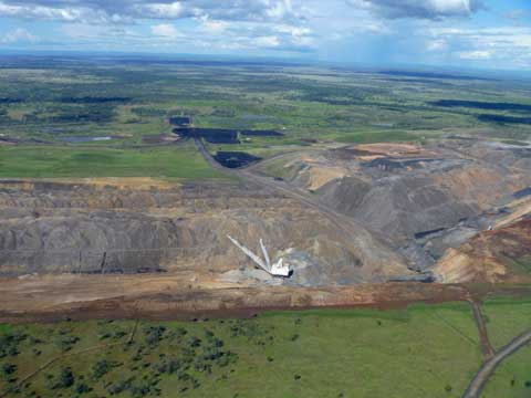
Xstrata’s Rolleston Mine (photo courtesy of the Tysons)

Across the highway, where Avriel and Lindsay Tyson’s ‘Springwood’ is under serious threat from Xstrata’s Rolleston mine (see post ‘When the neighbours get pushy’), another productive farming property has fallen to Xstrata.

On 23 July Avriel emailed that their near neighbour, Meteor Downs, one of the original Springsure district properties — ‘a beautiful old established property’ with lots of history and ‘43,000 acres of good country’ had just been sold by the by AA company to Xstrata – for $21.6 million.

‘So, so sad,’ says Avriel.

I couldn’t agree more. Where will it end, and who will stop these cashed-up and government-favoured mining companies gobbling up our land, our history and our future? No state government for sure.

River walking

North of Mudgee, the Goulburn River flows to meet the Hunter at Denman. This river has cut spectacular gorges and created world class natural wonders, as at The Drip — see my post about it, ‘Natural treasures.’

It flows through the Goulburn River National Park and some lucky private properties. I stayed at such a one — Stone Cottages — and went for a walk downriver.

At present the river here is a gentle and mainly shallow thread through sandy beaches, but I could see by the debris in the arching Angophora trees and the flattened vegetation on some banks that it knew how to assert itself when given the rainfall. But in the week the Hunter and the north coast were flooding, here we received only 5mm.

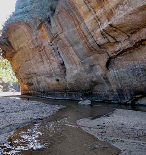
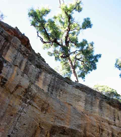
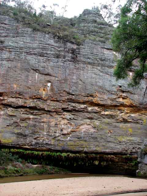
Walking down this river means that every now and then you strike giant cliffs like this one, Wave Rock, towering above the river bed. At such places you run out of beach and either wade across or climb over the top. I opted for wading after the first failed attempt at jumping. Wet boots are wet boots!

I wished the ancient Angophoras watching from the clifftop could speak of the sights they have seen over time.

On the northern side of the river the cliffs became more striated, almost tesselated in places, and pocked with holes large and small, clearly used by perching birds.

The rugged clifftops looked like pagodas in the making, as in the famous Gardens of Stone near Lithgow, now needing protection from coal mining. You can help by signing the Protect the Gardens of Stone petition.

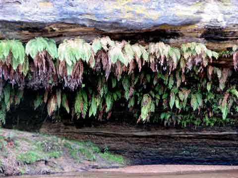
Where the river had undercut the cliff, a mini-Drip had been established, watering a sheltered hanging garden of rows of ferns.

These are just a few of the natural treasures of these gorges, at future risk from Moolarben’s longwall underground mining. Overhanging cliffs and cantilevered rock shelves may wear away over eons, but they aren’t going to cope with the sudden removal of the strata below, as already seen in the Lithgow region and graphically documented in The Impact of Coal Mining on the Gardens of Stone by Keith Muir of the Colong Foundation for Wilderness. Download the PDF here.

And for what? Profit for Chinese company Yanzhou.

The march of the methane-mongers

As the gas leaks and bubbles, and the contaminants creep into the falling water sources and the salt accumulates, as people itch at strange rashes, hold their heads with strange aches, or their stomachs with strange nausea attacks, and worry if they are drinking cancer-causing chemicals from the fracturing process or breathing them in from the gas flares — the coal seam gas (CSG) industry continues to advance across Australia. Gasland is here. This is Angus Bretherick, 6, with the rash his family say was caused by their local coal seam gas industry. Angus lives at Tara, hotspot of the Queensland methane push, and where residents had been complaining since 2008 about leaking gas wells and the dumping of CSG water on roads. (Photo: Courier-Mail 21.10.2010)

The Gasland film showed impacts of the coal seam gas and shale gas industry in the U.S. It put ‘fracking’ into all our vocabularies.

We have CSG rapidly spreading now; they are investigating shale gas, which always needs fracking, in three states. They want it all, in whatever strata the methane is hiding – for export, and ‘they’ are mainly foreign companies.

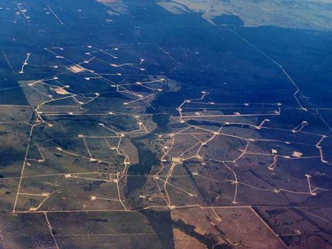
40,000 wells like these at a Chinchilla (Queensland) gas field have been approved in that state; the net of wells and linking roads and pipelines over the Darling Downs is more dense and more extensive now, a year later.

They can do this on your property; can you then imagine, as they claim, that CSG and farming can co-exist?

Read more

Minimal mining impact

Up near Capella, north of Emerald in Queensland, cattle farmers Mick and Margaret Shaw took on the Kestrel mine, objecting to Pacific Coal (Rio Tinto) wanting surface rights to mine under part of their mining lease, which extends over a fifth of the Shaws’ cattle property. 

They had seen the results of longwall mining under a neighbour’s property — cracking, subsidence, water running the wrong way. Their objections were dismissed by the Land and Resources Court; they appealed and won, since it was found that ‘the mining lease contained a fatal flaw, a technical error that made it invalid in relation to the Shaws’ land’. 

But then the Queensland Minister for Natural Resources said:

“The State’s interests in extracting its minerals resources for the benefit of the people were at risk” and so ‘they granted the company surface rights, not just to the small portion it had originally applied for but to all of the lease area on the Shaws’ land’. (ABC 7:30 Report 14.8.2002)

The Shaws felt this would make their property unviable, and the company should buy them out. But, as always, the company assured the government that the level of subsidence here would be ‘minimal’.

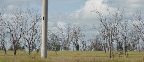
Local organic farmer Paul Murphy showed me that rollercoaster of a road at the top of this post, which demonstrates the ‘minimal subsidence’, 12 years after mining; two-metre deep dips — still sinking and constantly being repaired…

…and one other visible impact of those old longwalls — bands of dying established trees over the 265-metre longwall bands but not over the 30-metre gaps in between.

The mine owns most of the land now and leases it out, and I suppose they’d say that this most un-idyllic pastoral scene proves that agriculture and mining can co-exist.

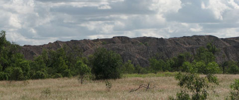
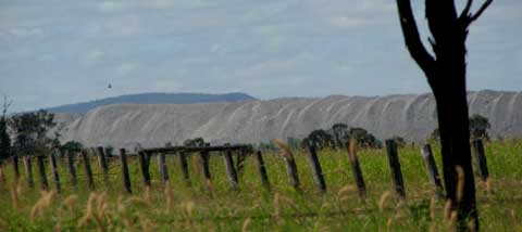
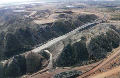
Of course, if people complain about underground mining, there are plenty of old overburden dumps left unshaped and unrehabilitated — in which Queensland abounds — for them to refresh their memories and choose which they found least invasive. There is never a choice for neither.

Don’t breathe the air

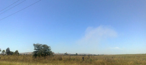
The once-rural Hunter Valley baked in the early February heatwave, but not under blue skies. The many and expanding open cut coal mines in Singleton and Muswellbrook Shires made sure of that. This was what the air quality looked like on Friday 4th February.

On the Tuesday before, the 1st February, the averaged PM 10 reading was ‘very poor’, exceeding national health standards where ‘people with heart or lung disease should limit exercising outdoors’.

We are told that local dust emissions could be reduced by half if best practice particulate emissions controls were put in place, and if there was ‘a substantial increase in the area of land rehabilitated each year and the application of suppressant to haul roads’.

Given the known health issues from dust particulates, why don’t they do this already? It would cost money, cut into profits.

Why aren’t they told to do it or shut up shop?

Surely not because it would displease donors, cut into royalties?

A friend sent this snap, taken from the road, of dust rising from the massive Mt Arthur mine at Muswellbrook, about two weeks ago. A common enough sight to those who live in the two shires, when passing any of the mines.

And yet the state government has just issued its NSW Coal and Gas Scoping Paper, where the scary assumptions are made that, rather than agree that these shires are over-saturated with mines and dust and power station emissions– they will get more.

‘The intensification of mining in the area between Singleton and Muswellbrook will require the careful management of potential cumulative impacts in an area that already accommodates substantial coal mining activity.’

The words say it all about the disconnect from the dangerous and dirty reality: ‘potential’? ‘accommodates’? ‘substantial’?

So we are not to worry, because it will be ‘managed’ as it is now, no doubt under equally strict consent conditions as now, since, as we are always told, the mining industry is the most highly regulated of all.

Comments are invited from the public until 15th April. Please have a read of what I consider an offensive draft blueprint for a coal-trashed future for NSW — it’s not very long — and let them know what you think!

Download it here: Coal and Gas Scoping Paper

Coal floods?

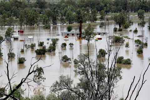
As central Queensland floods, I am hearing much in the media about the economic damage to the coal mines there, but not what those mines are contaminating as the floods surge through them. Or as the exposed coal stockpiles at every mine, rail loader and port loader wash into the floods.

 When the town of Theodore was evacuated, I immediately thought of the flatness of the country and the road to Theodore, which runs for kilometres beside the Moura mine’s heavy metal-laden overburden dumps, now washing into the rushing flood, and of their contaminated mine water, usually stored in earth-walled tailings dams.

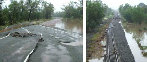
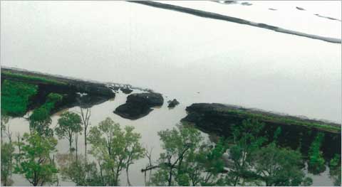
And if you ever thought road and rail were solid things, just look at how they have been pushed aside by  water — lifted like frosting on a cake, as shown by this photo of the Banana to Theodore route, passed on by Avriel Tyson from near Rolleston.

What will such power have done in all the mines up there?

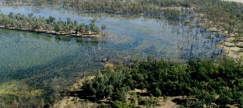
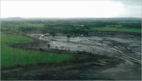
In previous floods, such walls have broken or been overflowed, and mines fined (tuppence!), as at the Ensham and Rolleston mines in the Emerald region, for releasing these toxic waste waters into the river system — and hence to the Great Barrier Reef. This photo, of the Rolleston mine flooding in that previous event, was taken by Avriel Tyson.

The Tysons have been isolated on their homestead island of slightly higher ground (which I had thought was flat when I was there) by the current unprecedentedly high flooding since late December, creeks breaking their banks that never have before, their road washed away — one of their heifers turning up 20 kilometres away! — and they are told that the next-door mine has had two metres of water over its railway line. 

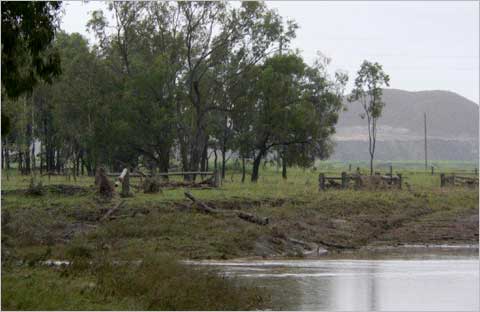
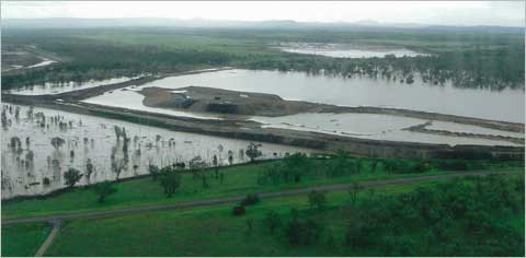
As the waters dropped, Avriel took photos of flooded Sandy Creek near their boundary, with the Xstrata mine behind.

Tysons have been here for over 100 years but Avriel says that this is a first; that the normal flood direction is baulked by the mine’s ‘ring tank levees and overburden piles’.

She wonders what the mine is doing with its water, and, looking at the debris on the fence and grid at their boundary with the mine,  I too wonder what invisibles the mine has deposited.

Farmers expect to work with flood plain systems, mines can’t.

There are about 40 mines in the Bowen Basin, many of which interfere with the natural spread and flow system of floodwaters, their massive earthworks blocking and channelling so the plain no longer functions as nature designed.

In the Surat Basin, increasingly sieved with a network of gas wells and test bore holes — Taroom, Chinchilla, Dalby — what will the aftermath damage be from all the submerged and tumbled drilling sites and pipelines? The photo above, passed on by Avriel, is on the Taroom/Roma road.

 Mine management ‘plans’ for hazardous materials and wastes may tick the government boxes for approval but they only work on paper, not on the flood plains. Thirty more mines are planned for the Bowen Basin in the next five years, and half of the existing 40 are expanding.

Poisoned river systems, poisoned silt deposited on farmland?  We need to hear from the mining industry how they are dealing with this aspect of multliple flooded mines, not just how it will hurt their profit margins.

All creatures…

On the first day of the new year, 2011, I choose to feature one of my smallest fellow residents, found lazing in a hydrangea flower.

And I think how lucky he is to live in a protected habitat where only his natural enemies can affect his life.

Yet even in a gazetted Refuge and with a conservation contract on my deeds in perpetuity, were there coal under us, nothing would protect him or me from mining. Coal does not follow the same laws as the rest of our land users.

And that has to change.

Coal needs to be deposed as King in this country.

My New Year resolution is to keep working to make that happen.

Climate Camp 2010

Last weekend I dropped into the last days of the Climate Camp being held at Lake Liddell recreation area near Muswellbrook in the Hunter. 

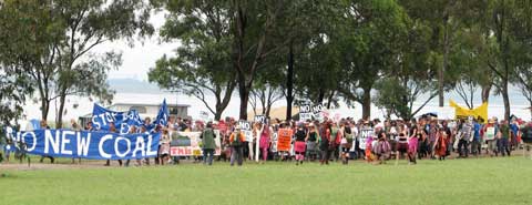
It was held here because near Bayswater Power station where a new one, Bayswater B, is threatened/promised, and which needs serious protesting against. An insanity, flying in the opposite direction of what is the publicised aim of Cancun. Has Mr Combet mentioned ‘coal’ yet?

Inspirationally, the Camp was just across the ‘lake’ from the Liddell Power Station and through the days and nights coal trains roared and rumbled along the nearby lines to the coal loader at Newcastle, the world’s largest coal exporting port.

They seemed non-stop — as they will actually be when even current expansions and approved mines get going — and they were as loud in that wide valley as a jet engine on the tarmac.

Some mines here and to the north and west do supply the two Hunter power stations, but most of the coal is shipped overseas to fuel climate change — they get paid more for that!

On Saturday night a wild and wet storm tested all the tents and made gumboots or bare feet de rigeur. They’d had a great week, I heard, with workshops and speakers and coalfields tours, where people from many states and even New Zealand  swapped information and drew strength from, as one participant said, this ‘family of environmentally concerned persons’.

I was delighted to meet in person two of the interstate activists who had helped me on my coal research trips: Sonya Duus, from Bimblebox in Queensland and Frosty from Bunbury in Western Australia.

As always, the last day was to be a day of community action and many Campers had put much effort and originality into the costumes, the placards and banners, and the songs and rap raves to brighten up the protest walk.

Many more folk turned up just for the walk; the police cars waited at the gate, the sun came out, and the colourful crowd of several hundred set off, to drums and whistles that stirred my heart, as if they were truly going into battle. As they were, for all of us and the planet.

I was staying behind to help others prepare food for them when they returned — which would be much later than expected.

Read more

When the neighbours get pushy

Springwood is a grazing property south of Emerald in Queensland. It is run — and loved — by Lindsay and Avriel Tyson and their adult children and families, who live there, as Tysons have done since the 1890s. All these photos were taken by Avriel. Springwood is beautiful, well watered — and at risk.

The neighbouring Meteor Park used to be a farming property until Xstrata turned much of it into their Rolleston open-cut coal mine in 2004. The track to Springwood runs close by the long piles of dirt and rock where the homestead and garden used to be. Only the mailbox remains.

The Tysons were worried about the effect on their surface and ground water, the creeks and wetlands, their lake and their bores.

This lake is about 5 miles around and 12 feet deep; they have counted 150 pairs of nesting black swans there — and that’s just what was easily visible.

Their Meteor Creek flows to the Fitzroy River and thence to the sea and the Great Barrier Reef at Rockhampton.

Then, in mid-2009, Xstrata announced to them that they were expanding operations — into Springwood — and they now have a mining lease over 7000 acres of it.

The Rolleston mine is moving into the alluvial plains, easy to mine — and easy to flood.  After heavy rains in early 2010 the Rolleston mine flooded; the banks of its dam burst and the resulting silty water rushed out, over the flooded pits and across the plains and into the creeks and wetlands. Mine silt is not just good clean mud.

They were fined $2000 — about 1.5% of one hour’s takings — for exceeding their water discharge into the Fitzroy catchment.

That’ll teach ’em!

Lindsay says that rainfall is always highly variable here, but can be up to 72 inches, and, given that we are expecting increasingly unpredictable and more extreme weather events, mining ought not be allowed anywhere near areas like this. Groundwater is gleaned and filtered and stored in more complex ways than mines ever acknowledge, but it’s an obviously unacceptable risk to mine alluvial plains, or flood plains or near creeks or rivers….

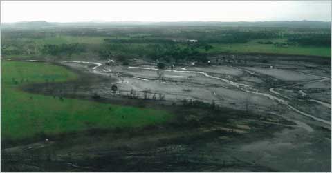
Mines can’t guarantee against damage to our water, regardless of what they say. Pictures like the one below reminded me of those of U.S. valleys polluted from mountaintop mining spills.

So why are we allowing this? The Tysons are doing their best, stressed but determined, losing time and sleep and business in trying to protect what they know is at risk, against their dominating and often intimidating neighbour, who have all the resources and the mining law on their side.

This is an unfair fight.

Scenic drive

I always hate leaving my mountain, but I especially hate it when my destination forces me to drive through the Hunter Valley between Singleton and Muswellbrook.

Each time I carefully consider which route will be the least distressing, with the least overwhelming views of the open cut coal mines that are almost continuous in this 50-km stretch.

At first I would stop and take photos of the looming overburden mountains or the milkiness of the polluted lower air layer. Now I rarely do.

Yet the other day, on a clear bright sunny morning after days of rain, returning to the land of dirt and disrespect for country and community, the scope of it struck me afresh.

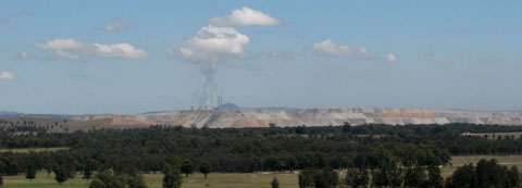
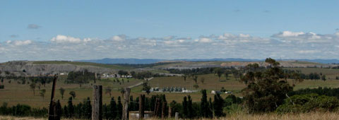
I stopped on a hill: on one side of the road I looked back to the power stations and the long multi-coloured piles of what the miners can’t use — just sitting there waiting for the breezes to blow their contaminated dust all over the valley.

On the other side of the road — facing the opposite direction — of course, another coal mine and more exposed overburden heaps. Thousands of hectares of this have replaced what was a rural valley, as the mines creep across the landscape, feeding and growing fat on coal, while the rest of us live with their waste.

Acland – death by coal

After 120 years as a town, Acland, only 35 km north of the city of Toowoomba in Queensland, has lost its community and services, almost all its houses and almost all its people.

It’s down to one landowner, Glenn Beutel, and the tenants to whom he has leased the old bakery building for the last decade, plus the occasional looter, visiting sympathiser or shocked and sickened ex-Aclander.

The rest have been cleared out, their house bought up by the (to me) obscenely named New Hope Coal, for their New Acland Coal subsidiary, which runs the New Acland Mine. Having worked their way through Stages 1 and 2, buying up farms in its relentless creep towards the town, New Hope is now awaiting approval of Stage 3, the application for which states they require ‘the removal of the town of Acland’.
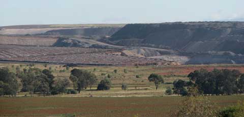
How best to make that a non-issue for consent conditions? Why, remove it in advance; hint to the residents that the mine will be on their doorsteps so they’d be better off selling now, start a panicked rush not to be left in a ghost town, get rid of the houses immediately, demolish the brick ones that can’t be moved and insist the buyer of the rest remove them all at once. Erase all traces of human habitation.

It’s a bit hard for a stranger like me to even find Acland, as the sign is gone from the turn-off.

Then pray — or Hope? — for the coincidence of the local Rosalie Council choosing to assume your company will win rather than support the townspeople, hence jump in and prematurely offer you all ‘their’ property, including the historic Acland No 2 underground Mine site and Museum, and the Park, war memorial and all.

You’d think that pretty well seals the fait accompli of Acland being replaced by New Acland, a town by an opencut coal mine.

But New Hope didn’t take into account that a town is more than buildings, a home more than a house, a war memorial more than a lump of polished stone. New Hope doesn’t seem to understand human feelings.

Glenn Beutel has stayed on because he rightly feels that it is premature to pronounce what’s left of Acland as dead until that Stage 3 is approved. If and when that happens will be the time to think about what he might do.

He has continued to care for Tom Doherty Park, Acland’s remaining history, so closely bound up with his family. It was largely due to the voluntary work of his late parents, Thelma May and Wilf, that the Park was  created, that Acland won Queensland’s first statewide Tidy Towns Award and that it was known as the Town of Trees, especially for all the Queensland Bottle Trees they had raised and planted. His mother was the instigator of raising funds to build that war memorial.
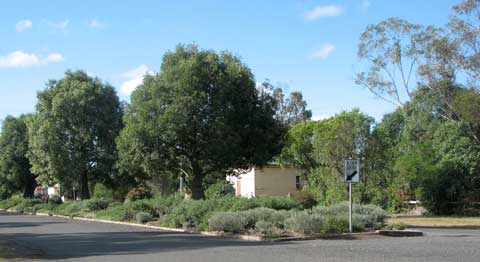
You don’t bury the loved one, no matter how seriously wounded and close to death, while they live and breathe. Acland is very alive still: there may not be many humans left, but plenty of koalas and snakes and lizards and birds and bees and butterflies call it home.
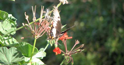
Despite New Hope selling off Bottle Trees for relocation, there is a habitat corridor of trees and shrubs and flowering succulents and geraniums and daisies — Thelma May’s legacy of water-saving plants — left in the Park and the median strip and verges and Glenn’s own garden.
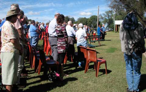
The war memorial has been the focus of an Acland Anzac Day service since it was built in 1991; nobody knows just what New Hope will do with it.  People feared that 2009 might be the last Anzac day in Acland, but things have dragged on in tensions and irresolutions – and so I was there for the 2010 service, along with 200 other people. Not a bad turn up for an almost dead town.

Glenn had the Park and the memorial looking great, his ‘Beutiful’ handmade wreaths of Acland flowers were handed out, ready to be laid at the base of the Roll of Honour.

It was a moving if painfully ironic ceremony, given what had been allowed by the government to happen to Acland, the opposite of the Aussie values, the Australia for which our forefathers had fought. They wouldn’t have believed this possible. 

When we all stood for the Last Post, I think most of us would have had those twin sorrows in our minds.
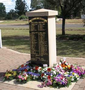
But the worst part was when the New Hope representative stepped forward to lay a wreath. The sudden intensity of the silence and the sharply focused resentment should have felled him on the spot if he had any sensitivity about what his company had done, was doing to these people.  This was not any Anzac Day ceremony; New Hope could have laid a wreath somewhere else if they wanted to pay homage. Like any enemy soldier, he would have acted under orders, but it would surely have occurred to them that as the invaders, the perpetrators, they should not be present as people here grieved, not just for the fallen soldiers, but for the fall of Acland.

Lest we forget indeed.
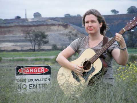
Another who was there that day and who has followed the Acland tragedy for some time is Frida Forsberg. Like me she has been driven to write about it, but Frida is a singer/songwriter so here is her deeply moving tribute to Acland.  She tells me she will be re-recording this more professionally and setting it to a slide show for YouTube later, but I couldn’t wait to share this. Get your hankies ready:

Anzac Day at Acland

Contact Frida here